Tuesday, 2 June 2026

The Greensand Way Part I - a Walking Perambulation


‘It was twenty years ago today…’ begin the lyrics of one of the many legendary songs of the Beatles. Twenty years must have seemed a long time to the young Paul McCartney when he wrote these lyrics which opened the 'Sgt. Pepper' album in 1967. After all, in 1947 we were barely over the Second World War and Paul was four or five depending which side of June the 18th we are!

Personally, I think the twenty years since I walked the entire Greensand Way footpath across Kent and Surrey have passed in a flash. The 110-mile trail begins in the village of Hamstreet, about nine miles from the English Channel and ends in the town of Haslemere in a far flung corner of Surrey. For my friend Tom and I, the Greensand Way formed the first half of a challenge to walk to the other 'Ham Street' in Somerset, which I documented in my travel book 'Mud, Sweat and Beers.'

For the 'china anniversary' re-walk I began with the local section, which falls under the borough of Ashford, back in the winter. The very beginning of the path is currently not signed at Hamstreet Crossroads, although I believe there are plans for a local info board to mark the start very soon. The gravel trail up through Hamstreet Woods (one of the UK's oldest national nature reserves) is a gentle and pleasant incline for cyclists, but upon reaching the brow of the hill, it's footpaths all the way to the settlements of Kingsnorth, Chilmington and Great Chart. I was pleased to see that the route of the trail around Chimington hasn’t been severely marred by the recent housing development, retaining a mostly rural feel throughout. Chilmington is essentially becoming a 'new town' bolted onto the southwestern fringe of Ashford. Beyond Great Chart, the route bridges the Ashford to Tonbridge railway line, and I had to abandon my walk due to the path being flooded all the way down to the Great Stour River near Godinton Park. I’ve never been a fan of swimming!

My second recent dabble at the Greensand Way covered the section which runs along the edge of Godinton Park, again not hugely troubled by the suburban developments, before heading west to pass to the south of Hothfield, descending towards the edge of Hothfield Common (a natural peat bog) and then up and over to Little Chart. From here on, I followed the Stour Valley Path to the village of Lenham, where ponds provide the source of one of Kent's longest rivers, which flows via Ashford and Canterbury, out into the English Channel at the little town of Sandwich, which gave its name to, er... sandwiches!

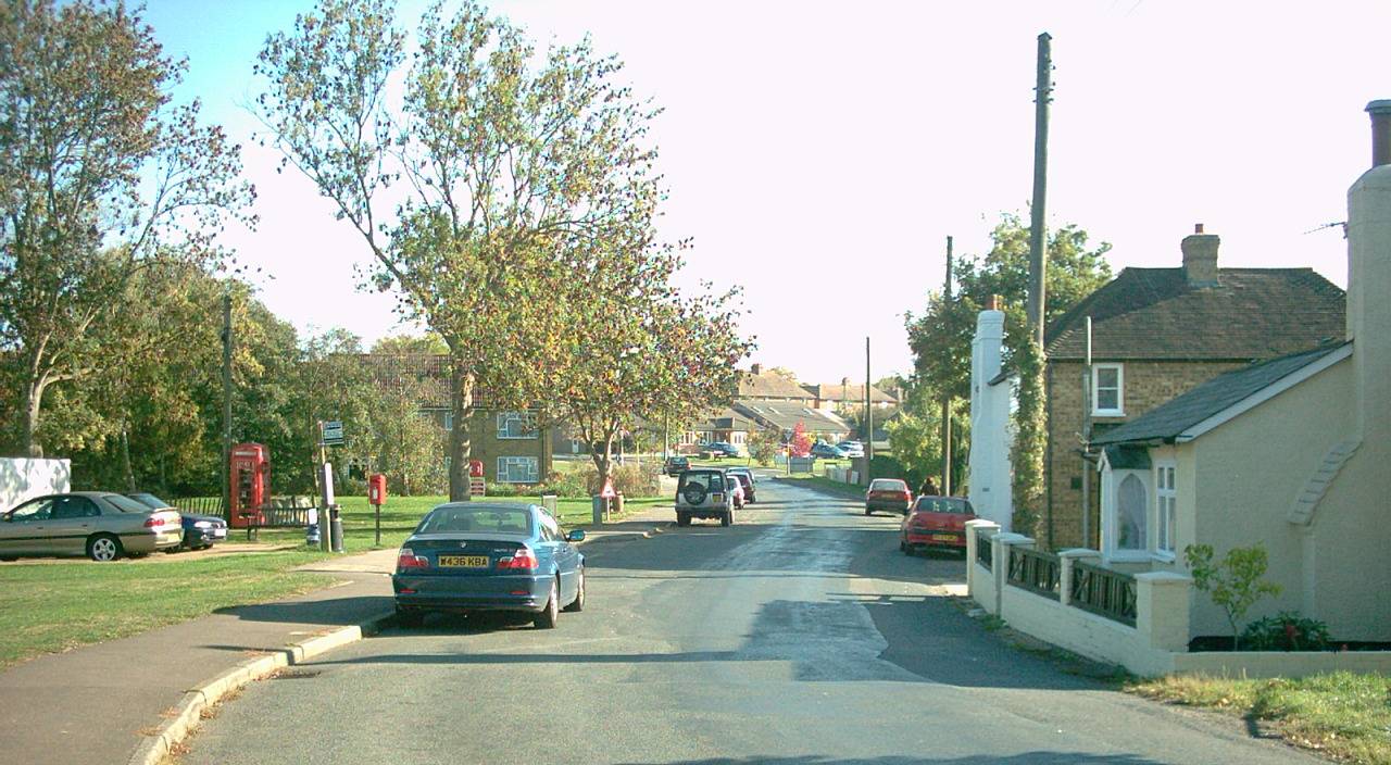
I walked my third section of the Greensand Way backwards (i.e. west to east), catching a bus from the village of Headcorn to pick up the trail at Sutton Valence, heading eastward. This was, and probably still is, my favourite section of the walk. Kent lives up to its epithet of being the ‘Garden of England’ here, with numerous orchards along the route. Whilst the section around Great Chart and Chilmington on my previous amble has the feel of a ridge, this is where the Greensand Hills, which give the path its name, really find their feet. The views southward from the top of the ridge are panoramic, and the path remains fairly high up the slope until dropping off beyond Boughton Malherbe. After Egerton (pictured), the route dips and then climbs again to Pluckley (reputedly England's most haunted village), where the orchards take over again for the descent to Little Chart. After a pint in the Swan’s beer garden, I negotiated a route to Pluckley Station, being somewhat gutted to find that Dering Arms was closed and the next train was in 55 minutes time. Time for some stoicism.

Then on the first May bank holiday, I booked myself a Travelodge in Dorking, with the aim of completing the sections of the Greensand Way west from Reigate to Dorking and east from Reigate to Oxted. Alighting the train at Reigate Station, the town is reached via a foot tunnel, which was the first road tunnel to be built in the UK, opening in 1823. This was constructed for the ease of stagecoaches, travelling from London to Brighton, so-called because these long journeys were completed in stages, with a change of horses being needed at regular intervals. The route of the Greensand Way to Dorking was far more scenic than I remembered it from 2006. The path drops dramatically into the valley of the River Mole, which runs from Gatwick to the Thames. The Greensand Ridge doesn’t reassert itself until Dorking area, leaving the North Downs on the right hand side to dominate the skyline. I passed through the pretty villages of Betchworth and Brockham and passed a small woodland that I camped in during that original thirteen-day hike. I described this as ‘cake shaped’ in my book and I can confirm that it still gives that impression! The 'cherry on top' was passing a blue plaque in Dorking marking Strawberry Studios where 10cc, Paul McCartney, Steveie Wonder and others had all recorded music.

On the following day I would catch the train to Reigate and walk the ‘GW’ eastward. It was nice to walk a section of the trail that my friend Tom and I had completely missed twenty years ago, having made a hash of the map-reading, ending up in Redhill town centre. Thankfully, modern smartphone apps make following a trail of this kind much easier today. However, signage for the trail was still non-existent on the lanes to the west of South Nutfield so I reported this to Surrey County Council. Modern smartphones make this easier too!

My lunchtime refreshment break was at a pub in Bletchingley, a village straddling the A25 at the top of the ridge. It was doing brisk business and the barmaid was clearly feeling the pressure. The next section feels similar to the Pilgrims’ Way, a more famous trail which runs along the (also more famous) North Downs. Here, the 'GW' runs along the lower part of the ridge’s scarp slope in an easy-to-follow straight line. Crossing the busy A22 near Godstone was more of a challenge, but the section via Tandridge to Oxted passed very quickly. Oxted is perhaps most famous for the being the childhood home of a certain Keir Starmer. Not far from here is the furthest known mention of Hamstreet, where the ‘GW’ crosses the Kent border, with the village signed as being 55 miles away but we'll be visiting that in 'Part II' of this report. For now, we'll trundle down to Hurst Green Station and catch the first of four trains home.


Saturday, 7 March 2026

Instant Poetry - War & Climate Change


Inspired by Bruce Springsteen's Dylanesque protest song 'Streets of Minneapolis,' I thought I'd throw an an environmental slant on the latest horror show from the Middle East. The image is of an E.P. I released under the name of 'Adam Colton and Teresa Colton' (although this was a solo effort). Please seek out our music on your favourite online provider if curious...


Lots of explosions filling the air,

More refugees, but does anyone care?

Houses blown up, plumes fill the sky,

Does anyone ever stop to ask why?


Remember when Trump said to Zelensky,

You’re gambling [around] with World War Three?’

But his Nobel Peace Prize chances are blown,

So now he’s embarked on a war of his own.


For years we’ve been trying to stop climate change,

Meanwhile our ‘great’ leaders, they still act the same,

We turn off lights, while they fill the skies,

With non-stop explosions, this cannot be wise!


Trump hopes that Putin will be a good mate,

If he finds his country a 51st state,

Canada, Greenland or Gaza will do,

He’s trying to look big to impress you-know-who –


No money for healthcare or helping the poor,

But billions of dollars to start a new war,

And don’t disagree with him, ‘cause he’s got ‘ICE,’

And they’ve all got guns and they’re not very nice!


When COVID hit hard, we all had to change,

But everything then got put back just the same,

Was that our last chance to cut down emissions?

Instead our world leaders took warring positions.


So don’t blame the people who’ve had their homes burned,

It seems that humanity still hasn’t learned,

But when the tides rise and the crops die away,

Trump and his mates will still be OK.

Thursday, 26 June 2025

Hamstreet, Kent - Concise Information for Visitors


Location: 6 miles south of Ashford, Kent

Population: 1988 (2021 census)

Parishes: Orlestone and Warehorne 

New Book on Hamstreet OUT NOW


Introduction to Hamstreet

The village of Hamstreet used to be a mere hamlet known as ‘Ham’ with most of the population living at Orlestone, a small settlement based around the pretty parish church of St Mary one mile north of the village.

When the Romney Marshes were properly drained, Hamstreet became more desirable, being strategically located at the cross of the Ashford to New Romney road and the current Tenterden to Hythe road. The coming of the railway in 1851 boosted the village’s growth, which has continued steadily throughout the last hundred years. The Ashford to Hastings line is now one of only two diesel lines in the provincial Southeast.

Today, the village encompasses Orlestone parish and part of Warehorne parish. The village is twinned with Therouanne in France.


Countryside

The area around Hamstreet is relatively unspoiled, in spite of the busy bypass (built in 1994) and the southward growth of Ashford. There are many traditional Kentish weatherboard buildings at the village centre. The flat nature of the marsh means that the quiet winding lanes are very popular with cyclists. There are also three long-distance footpaths here: the Greensand Way, the Saxon Shore Way and the Royal Military Canal Path

The first two paths pass through Hamstreet Woods (SSSI), which is a large protected reserve of deciduous woodland where you will find many trails and may even hear a nightingale. A second area of public woodland can be found a mile north of Hamstreet at Faggs Wood / Orlestone Forest.

Link to walking guide here:

Link to cycling guide here:


Fame

Hamstreet had its moment of fame in 1991, appearing in map form on every postage stamp in the UK. This was to commemorate 200 years of the Ordnance Survey, because the Hamstreet area was the first to be mapped as part of a nationwide survey. The set of four stamps effectively illustrated the changes to the village over time.

Hamstreet was also featured in BBC TV's ‘Blue Peter’ as the 'base camp' for a humorous charity exercise involving climbing the 'Marsh Mountain.'

The writer, Joseph Conrad once lived near Hamstreet, and Noel Coward owned a residence at nearby Aldington, where several TV personalities have also lived. H E Bates would have been familiar with the village, and the wider area of Romney Marsh has many literary connections, including the Dr Syn books and the Ingoldsby Legends.

There is also a memorial at Johnson’s Corner (the southern bypass exit for the village). This marks where a heroic American pilot crash-landed in the Second World War after allowing his crew to parachute to safety.


Leisure

Hamstreet is a popular base for ramblers due to its variety of shops, station, Old Schoolhouse Indian restaurant, chip shop, Cosy Kettle cafe and pub.

The Duke’s Head was originally located on the High Street itself, but was rebuilt in the 1930s back from the road to accommodate coaches. The Pavilion (Pound Leas) is another popular venue.

An ale trail can be enjoyed by heading along Warehorne Road and onto the Saxon Shore Way across the fields, to the 16th century Woolpack Inn, which is linked to the church of St Matthew by an underground smugglers' tunnel. Although small, Warehorne used to have a second pub – the World's Wonder, one of five in Kent built to the same design.

Alternatively one can follow the canal path east from the garden centre (half a mile south of Hamstreet village centre) for 2½ miles and wander uphill along the lane at the second bridge to the White Horse, Bilsington. You will notice a monument dedicated to a local landowner, Sir Richard Cosway. Sadly Ruckinge (passed en route) surrendered its Blue Anchor pub to history in 2015.

Full village blog page here:


Tuesday, 8 April 2025

Thoughts on Sheffield


If you look at a map of the country and squint slightly, you can see four big blobs of urbanity running up the middle of England like the buttons on a jacket. These are Northampton, Leicester, Nottingham and Sheffield. Having visited the first three, my most recent trip was to the town that is the home of the world's oldest existing football club (not 'United' or 'Wednesday' but Sheffield FC, founded in 1857). However, I didn't visit the ground as it was about six miles to the south of the city centre. Sheffield is arguably the fifth largest city in England after London, Birmingham, Manchester and Leeds.

As with Nottingham and Manchester, there is a tram service in Sheffield. However, my aim was to walk to the southwestern suburb of Ecclesall, as my paternal grandfather was born there, in the days when it was a village just outside the conurbation. It was a long uphill walk of about three miles from the city centre and I popped into the parish church, where I was pointed in the direction of the vicar who managed to track down some info on Colton graves for me.  My grandfather struggled to settle back in Sheffield, working as a crane driver after World War I service, so he went off to search for 'gold' in California. He didn't find any, so he joined the Canadian army's Princess Patricia Regiment, eventually meeting my grandmother who was working as a house parlour maid in Winnipeg. Moving back to Sheffield, they soon relocated in the Kentish town of Ashford, which is how I came into the world as a 'Southern Softie' who loves black pudding and isn't averse to gravy on chips.

My next port of call was the childhood home of Jarvis Cocker, the lead singer of the nineties band, Pulp. Personally, I think that their hit 'Common People' epitomised the decade that my generation now view with rose-tinted glasses, but the band had been around for many years before remotely troubling the music charts. I took a very scenic amble eastward to the suburb of Intake, but I was unable to view the front man's front door. Or indeed any of his former residence. However, the wander back into the city centre was pleasant, with a great view before descending past an amphitheatre. I popped into a quaint looking pub which played continuous classic rock music and had a range of real ales from mild to porter. Bliss. The barman was from Lincolnshire but he said that he had found it a struggle to fit in in South Yorkshire, intending to move back home.

On the second day I followed the River Don upstream (westward). Near the industrial heritage site of Kelham Island there was a big mural of Jarvis Cocker smoking a cigarette on the side of a building (great role modelling for kids!). I then climbed steeply beside Ruskin Park and the suburb of Walkley - a typically ‘northern’ slice of urbanity (terraced streets on steep hills) and I descended a steep lightly wooded bank to reach the Rivelin Valley – a very picturesque river walk with stepping stones across at one point. Sheffield is at the eastern edge of the Peak District and some of the city actually falls within the national park. Indeed, the city is said to stand on seven hills - an epithet it shares with Rome. However, a glance at Wikipedia will reveal a whole host of other places in the UK which also make this claim.

I ambled as far as the Rivelin pub where I enjoyed two pints of excellent mild ale. Mild has almost died out in Southern England but the appeal of all the taste with none of the headache seems obvious to me. So what other delights are there to be seen in Sheffield?

The cathedral, dedicated to St Peter and St Paul, seemed an unusual shape to me and it has a crypt – I looked around this at night while a concert was taking place, using the torch on my mobile phone. The Crucible is of course home to the world snooker championships, but really unless the snooker is on there's nothing particularly striking about the building itself. However, nearby is the Winter Garden which I would describe as being like a huge conservatory containing trees of the world. There is a free museum attached but sadly I didn't have time for a thorough look round before needing to catch my train home.

There is also a 'walk of fame' near the town hall, with famous names such as the singer Joe Cocker (popular surname, huh?), the athlete Sebastian Coe, Monty Python's Michael Palin and the actor Sean Bean. Think of the Hollywood 'pavement stars' and scale it down a bit! During my visit I found scant mention of the Arctic Monkeys however – a Sheffield band that were a huge phenomenon in the noughties, arguably as the city’s Def Leppard were in the eighties. In an earlier post I've suggested a similar attraction for my home town of Ashford, which can muster Bob Holness (of 'Blockbusters' fame), John Furley (founder of the St John Ambulance), John Wallis (inventor of the infinity symbol) and the author Frederick Forsyth, as well as a claim to having had the first white lines on any road in the UK. It seems that the north / south divide is one of pride in many cases, with northerners keen to promote their towns and their heritage while southerners generally run their towns down. We give our towns nicknames such as 'Trashford' and 'Jokestone,' but is this affectionate, in the way that courting couples banter with one another? Maybe we love our towns, with all their flaws, after all. 

Who knows, but I intend to check out Leeds next, in order to tick another big conurbation off of my 'must visit' list.