Location: 6 miles south of Ashford, Kent
Population: 1988 (2021 census)
Parishes: Orlestone and Warehorne
New Book on Hamstreet OUT NOW
Introduction to Hamstreet
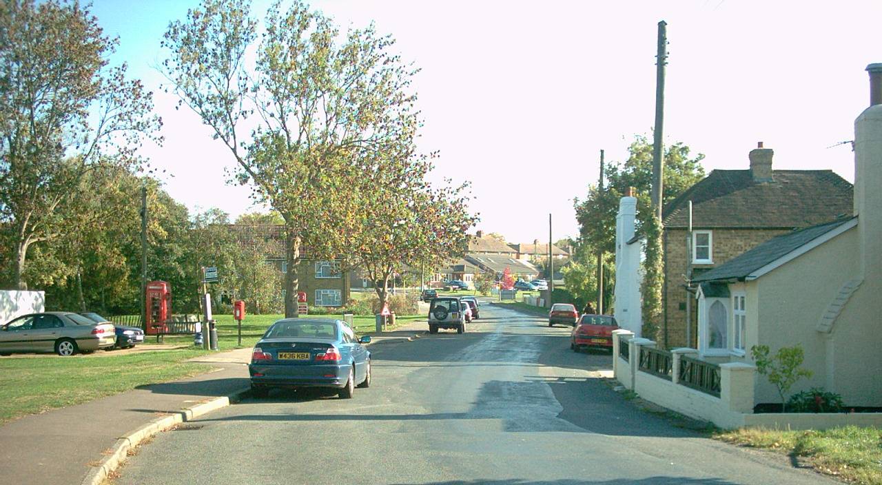
The village of Hamstreet used to be a mere hamlet known as ‘Ham’ with most of the population living at Orlestone, a small settlement based around the pretty parish church of St Mary one mile north of the village.
When the Romney Marshes were properly drained, Hamstreet became more desirable, being strategically located at the cross of the Ashford to New Romney road and the current Tenterden to Hythe road. The coming of the railway in 1851 boosted the village’s growth, which has continued steadily throughout the last hundred years. The Ashford to Hastings line is now one of only two diesel lines in the provincial Southeast.
Today, the village encompasses Orlestone parish and part of Warehorne parish. The village is twinned with Therouanne in France.
Countryside
The area around Hamstreet is relatively unspoiled, in spite of the busy bypass (built in 1994) and the southward growth of Ashford. There are many traditional Kentish weatherboard buildings at the village centre. The flat nature of the marsh means that the quiet winding lanes are very popular with cyclists. There are also three long-distance footpaths here: the Greensand Way, the Saxon Shore Way and the Royal Military Canal Path
The first two paths pass through Hamstreet Woods (SSSI), which is a large protected reserve of deciduous woodland where you will find many trails and may even hear a nightingale. A second area of public woodland can be found a mile north of Hamstreet at Faggs Wood / Orlestone Forest.
Link to walking guide here:
Link to cycling guide here:
Fame
Hamstreet had its moment of fame in 1991, appearing in map form on every postage stamp in the UK. This was to commemorate 200 years of the Ordnance Survey, because the Hamstreet area was the first to be mapped as part of a nationwide survey. The set of four stamps effectively illustrated the changes to the village over time.
Hamstreet was also featured in BBC TV's ‘Blue Peter’ as the 'base camp' for a humorous charity exercise involving climbing the 'Marsh Mountain.'
The writer, Joseph Conrad once lived near Hamstreet, and Noel Coward owned a residence at nearby Aldington, where several TV personalities have also lived. H E Bates would have been familiar with the village, and the wider area of Romney Marsh has many literary connections, including the Dr Syn books and the Ingoldsby Legends.
There is also a memorial at Johnson’s Corner (the southern bypass exit for the village). This marks where a heroic American pilot crash-landed in the Second World War after allowing his crew to parachute to safety.
Leisure
Hamstreet is a popular base for ramblers due to its variety of shops, station, Old Schoolhouse Indian restaurant, chip shop, Cosy Kettle cafe and pub.
The Duke’s Head was originally located on the High Street itself, but was rebuilt in the 1930s back from the road to accommodate coaches. The Pavilion (Pound Leas) is another popular venue.
An ale trail can be enjoyed by heading along Warehorne Road and onto the Saxon Shore Way across the fields, to the 16th century Woolpack Inn, which is linked to the church of St Matthew by an underground smugglers' tunnel. Although small, Warehorne used to have a second pub – the World's Wonder, one of five in Kent built to the same design.
Alternatively one can follow the canal path east from the garden centre (half a mile south of Hamstreet village centre) for 2½ miles and wander uphill along the lane at the second bridge to the White Horse, Bilsington. You will notice a monument dedicated to a local landowner, Sir Richard Cosway. Sadly Ruckinge (passed en route) surrendered its Blue Anchor pub to history in 2015.
Full village blog page here:

