Showing posts with label Romney Marsh. Show all posts

Saturday, 12 December 2020

Hamstreet, Kent - Portrait of a Village

[Transcript of original web page. Last updated June 2025]


LATEST NEWS: 
War memorial completed
Footpath from Ashford Road to the Pippins now open
Village has three vacant shop units
Online parish magazine free to view

Introduction to the Village


"Hamstreet is 'interesting' and retains the characteristics of a traditional and proud working village, something that is increasingly rare," - Kent Life Magazine.

This Kentish village is affectionately known as ‘the gateway to the marsh’, being located six miles south of Ashford where the ridge of clay hills meets the flat expanses of Romney Marsh, an area once awash with smuggling. The village was bypassed in 1994, but remains an important junction and is twinned with the little town of Therouanne in France. Therouanne was once a city with a cathedral which was sacked by the troops of Henry V. The stone cannonball near the flagpole in Hamstreet was a gift from the mayor of the twin town, presented with the words 'You can have your cannonball back!' More local history can be perused on the Forge Gardens noticeboard and at the station.

Traditional weather-board buildings and a generally unspoilt appearance make the place well worth a detour from the beaten track. Three long distance footpaths pass through the village; the Royal Military Canal Path follows the peaceful banks of a 28-mile waterway - the UK's third longest defensive structure, and the Saxon Shore Way and Greensand Way pass through the expansive deciduous woodland of Hamstreet Woods. In fact, the Greensand Way begins its 110-mile course to Haslemere at the village crossroads. A walk incorporating both the canal and Hamstreet Woods was featured in the 'Top 50 best summer walks in Britain' in the Independent newspaper. A second area of public woodland is located northwest of the village at Orlestone Forest.

To get a reasonably accurate population for the village as a socio-economic entity, add together the populations of Orlestone and Warehorne, for the boundary runs through Hamstreet itself. This amounts to 1,988 people (2021 census). Orlestone is the original location of the village - now just a hamlet, a mile to the north, centred around the eleventh century parish church of St Mary. The Church of the Good Shepherd is a more modern place of worship in the village's High Street and the ancient church of St Augustine's in Snave also comes under Hamstreet and holds one service annually at harvest festival. The church in Warehorne is dedicated to St Matthew. The area is great to explore on foot or by bike.

Hamstreet's Claims to Fame


H E Bates who wrote 'The Darling Buds of May' would have known the village well, and the writer Joseph Conrad resided at Capel House (one mile north of the village) from June 1910 to March 1919. The modern generation will perhaps be most familiar with the film 'Apocalypse Now' which was heavily influenced by his book 'Heart of Darkness.' In the late 1990s, the village pub was briefly managed by Patrick Murray who played Mickey Pearce in TV's 'Only Fools and Horses.' Many celebrities have lived within the wider local area including Vic Reeves, Bob Mortimer, Paul O'Grady, Noel Coward, Julian Clary, Alan Carr, the actress Jan Francis and international golfer, Peter Mitchell. Hamstreet has also been featured in futuristic writings by Sir Peter Hall and David Boyle. But what of the village itself?

Mountain Farm in Hamstreet once featured in BBC TV's 'Blue Peter' as a base camp for an expedition up the 'Marsh Mountain’. Romney Marsh is of course completely flat, so this humorous concept involved presenters turning a map of the area upside down and crawling along the road!

Hamstreet had its real moment of fame in the early 1990's, with maps of the village appearing on postage stamps all over the UK. John Craven even did a 'Countryfile' special on the village. This was to mark 200 years of the Ordnance Survey. Hamstreet was chosen because the area was the first to be mapped as part of a nationwide survey and the changes to the village over the years showed up very well on a series of stamps.

The village was featured on BBC South East Today's 'On The Map' feature in May 2021. Hamstreet was also on the route of the Tour of Britain cycle race which passed through in September 2006, and the Olympic Torch relay passed through the village en route to London for the 2012 Olympic Games. Search for 'Olympic Torch Hamstreet' on YouTube to view the relay and watch TV clips of the village here.

Business


Until 2013 there were five pubs within three miles of the village cross. At present there are three - the Duke's Head in Hamstreet itself, the Woolpack Inn in Warehorne and the White Horse in Bilsington. The Blue Anchor (Ruckinge) and World's Wonder (Warehorne) have sadly been allowed to disappear.

In the High Street there is a post office / general store, fish and chip shop, the Old Schoolhouse Indian restaurant, a curtain / blind shop, the 'Saw Joinery' DIY/joinery centre, Lilly's Ink tattoo studio, the Cosy Kettle cafe, Early Birds renovations and Smart Dogs grooming centre. The Woodville unit is currently vacant.

Marsh Road has Annings Motors garage and Hamstreet Garden Centre which also has a cafe. There is currently an empty shop unit at the garage. Hamstreet Primary Academy (the school) is located in Ashford Road.

In Warehorne Road there is a dental clinic and Angela Hirst estate agency. There is currently an empty unit where the hairdresser’s used to be. Travel just out of the village and you'll find a vineyard, the mild climate of this part of Kent being particularly good for wine production.

Meanwhile, Ruckinge Road is the location of Joanne Fuller Beauty and Hamstreet Surgery, as well as the Nexus Programme office. A little further out of the village on Ruckinge Road is Meadow View Industrial Estate which contains several businesses.

Fun and Festivals


The village has a games area/tennis courts and a bowling green, as well as many clubs and associations too numerous to list. These include the Ruckinge and Hamstreet Scouts and Guides (HQ in Ruckinge), the Royal British Legion and the football club. Many activities and clubs take place around the village at locations such as Victory Hall, Cosy Kettle cafe, primary school and Church of the Good Shepherd (which has its own hall attached). 

The Pound Leas pavilion has its own bar area, augmenting the flood-lit 'multi-use games area' and football field, all of which are the result of many years of fundraising. The Festival of Transport which used to take place every June was featured in a Live TV (satellite) documentary programme in 2009. Sadly this event folded in 2016 but the village does have a community music day each summer in its place. There are also regular 'bikejumble' events on the fair field for petrol heads. 

Also look out for posters for Hamstreet bonfire and fireworks on Pound Leas each November (although this didn't take place in 2024). For those wishing to stay locally, accommodation is available at the Woolpack Inn, a pleasant stroll across fields on the Saxon Shore Way.

Transport facts


As well as daytime bus services to Ashford, New Romney and Lydd (Mon to Sat), Hamstreet has a railway station on the Ashford to Hastings line - one of only two remaining diesel lines in the provincial Southeast. Trains run direct to Eastbourne as well as Ashford for connections to London.

The village is well signed on the A2070 trunk road between Ashford's Southern Orbital Road and Brenzett, and between Aldington and Woodchurch on the B2067. The village used to be signed comprehensively in Tenterden and also from New Romney, Lympne and Appledore Heath. In spite of past campaigns for a return to better signage on grounds of being a junction point on a trunk road and a hub for local services, the village remains signed at the most basic level. Interestingly, there is a memorial at the southern exit for Hamstreet on the A2070 in honour of Liuetenant Johnson, a USA pilot who lost his life here during World War II after allowing his crew to parachute to safety. 

Details of useful cycle routes can be found in the 'Royal Military Canal and Associated Routes' blog, and circular walking routes can be found in the 'Smugglers and Saxon Shore Walks' blog. The A2070 and B2067 also have narrative blogs on this site detailing features along these routes, and the 'Ashford and Shepway Roads Database' blog details routes around the wider area.

Nostalgia 


The house on the corner of Ashford Road and Warehorne Road is believed to be the oldest in the village. It was a bakery until the 1980s, and a post office too until 1970, when a new post office was built at Bridgewell (now a private house in the one-way street). In the 80s the post office moved to the Mace store (now an office), finally settling at its current location in the Morrisons store, which itself was previously an independent store, then VG, Costcutter and McColl's. Hamstreet was briefly graced with a baker's shop again when the Chocoloate Box newsagency closed in 2012. There was a second newsagency (Harden's) located at Old Stores House in The Street until the 1990s.

Prior to use for beauty purposes (pre-2025), the shop at Woodville was an antiques shop, and before this a butcher's store. When the butchery closed in the 1980s, a butcher's counter was positioned at the rear of the VG store (now Morrisons) for a number of years. Villagers had a choice of garages, both with filling stations, at the time too. The second of these, Tippen's, was located where the small housing development between the former Chocolate Box and the church now stands.

Until the 1990s Hamstreet had a police house in Warehorne Road. The Indian restaurant was the original site of Hamstreet School until the current school was built in 1882. Prior to its current use the Old Schoolhouse was an antique shop, a photocopier centre, a tea room and the Masters restaurant.

The shopping area in Warehorne Road housed a greengrocer and a wool shop in the 1980s. It is also believed that when Viaduct Terrace was constructed in the 19th century, there were plans for the southernmost end of the terrace to be a pub. The Duke's Head is in fact a rebuild; the original pub opened its front door directly onto The Street and was originally named 'The George', 'The Three Mariners' and then 'The Duke of Cumberland'. The twin pub of the current Duke's Head was the former Stonebridge Inn at Woodchurch. Hamstreet also had a twin station building, at Winchelsea in East Sussex. 

Meanwhile, the former World's Wonder in Warehorne was one of five Kentish pubs which were built to the same design. The others were the now-bulldozed Ship at Lade (Romney Marsh), the former Bell Inn at Coxheath, The Redstart Inn at Barming and The Papermaker's Arms at Hawley (Dartford).

Hamstreet exchange phone numbers consisted of four figures prior to standardisation of the 01233 Ashford area code. The telephone exchange is still located next to the railway station. The old exchange is located at the top of a flight of steps to the south of the railway bridge in Ashford Road.

Development names for recent estates were Orchard View (Bankside), Saxon Woods (Lancaster Close), Brook Gate (Orlestone View), The Pippins (Ingoldsby Lane, etc.) and Nightingale View (Brimstone Road, etc.).

Campaigning


There are three vacant shop units in the village centre which the creator of this blog hopes will be filled to keep the village centre buoyant.

Two large new housing developments are being completed. The focus on expensive four and five-bedroom houses within new developments has been an issue, while the further fragmenting of the village across two parishes means a lot of the extra council tax going to neighbouring villages rather than Hamstreet. It would make sense for any new developments to be entirely within the parish of Orlestone to create cohesion.

In 2008 Pumpkin TV produced a DVD for geography students which used Hamstreet as a case study for challenges that affect many English villages. It has sometimes been very frustrating to see a minority fighting plans for new business when so many outlets have been lost over the years. Beginning in the late 1990s the author of this site has attempted to challenge the status quo. 

This began by escalating complaints when the village's railway station ticket office was closed for a period of over six months in the late 1990s, and continued with expressing support for the Indian restaurant to be allowed to provide a takeaway service, for the doctor's surgery to expand, for a fish and chip shop to be allowed, for a new cafe to be allowed and for changes to the Woolpack Inn which ultimately enabled this popular pub to reopen in 2015. A plan to upgrade the canal towpath as a proposed cycle link between Hamstreet and Appledore has sadly gone quiet in recent years.

The truth is that one person cannot change a village, and I would personally encourage villagers to use the 'search' and 'comment' facility on Ashford Borough Council's planning website to support new amenities and object to further losses of business space whenever such proposals arise. I hope that the quote from 'Kent Life' magazine which began this post will be as true in years to come as it is at the time of writing.

Credits and links


This page has been put together by Adam Colton, a local author of UK travel, music reviews and psychological fiction. Please visit the author page on the Amazon website, Smashwords, iBooks, etc. for details of available books. Adam is also one half of the musical duo Adam Colton & Teresa Colton. Check out their songs on YouTube, Spotify, iTunes and other music sites. Also, please search for the names of any of the businesses, clubs, amenities or venues mentioned on this page that aren't listed below.

The twin village of Therouanne (link here) in France. 

Hamstreet Woods national nature reserve

BBC news report on the 2012 Olympic Torch relay here


Morrisons Store (The Street)

Dog grooming centre (The Street)


Joanne Fuller Beauty  (Ruckinge Road)

Nexus Programme Office (Ruckinge Road)

Doctor’s surgery (Ruckinge Road) 

Dental Clinic (Warehorne Road)

Angela Hirst Estate Agency (Warehorne Road)

Hamstreet Wines (Warehorne Road)

Warehorne Vineyard (Warehorne Road)

School (Ashford Road)

Dukes Head (The Street)

White Horse (Bilsington)

Woolpack Inn 
(Warehorne)

Scout and Guide Associations (shared with Ruckinge)

The Victory Hall committee

Link to 'bikejumble' events 


The parish council's site is here


There is now a sister-page on this blog about the nearest town of Ashford

Wednesday, 9 March 2016

Hamstreet, Kent - Saxon Shore Walking Routes

[NEW EASY-TO-FOLLOW CIRCULAR WALKS. Last updated June 2025]


The information on this page may be freely copied for use on walks.

The village of Hamstreet is surrounded by public woodland including Hamstreet Woods, an area of special scientific interest renowned for the presence of wild service trees and nightingales. 

The routes in this guide explore the contrasting elements of the local area, including Romney Marsh and the banks of the Royal Military Canal. 

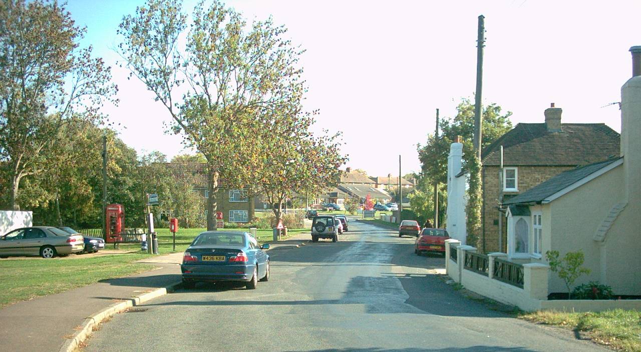
Hamstreet is a great base for walkers because of its railway station, coffee shops in both the High Street and garden centre, fish and chip shop, Indian restaurant, shops and the Duke's Head pub (lunchtime dining Tues-Fri and all afternoon on Sunday). Note: locations in capitals are reference points that appear in different walks; wordings in italics are optional alternatives.

Warehorne Loop (3½ miles) - Saxon Shore Way and Canal Path


Head towards Tenterden along the B2067 from the village crossroads. Use the road crossing beneath the arched railway bridge and continue to the road bridge (on the right-hand side there is a path parallel to the road along Waylett Crescent and back down to the B2067). After passing beneath the A2070 bridge, climb the steps on your left. A short distance along this stony path, there is a stile to your right. Climb over and follow the Saxon Shore Way in a straight line towards the church tower across the fields. Passing through a number of swing-gates, the route descends into a dip and climbs again to reach a stile surrounded by bushes at the top right corner of the final field. Cross the stile and follow the driveway ahead, turning right when you reach the lane.

On your right you will see the sixteenth century WOOLPACK INN, which is connected to the church of St Matthew by an underground tunnel. This was built and used for smuggling, a common activity in this area in centuries past.

Take the path, left, via the churchyard and walk around the west side of the building. If you imagine a straight line right through the church bearing slightly left, this is roughly the route of the footpath down to the lane via the bushes to the left of the house at the bottom. When you emerge back onto the lane, bear right to cross the level crossing and continue down to Warehorne Canal Bridge. The Royal Military Canal was built as a line of defence against a feared invasion from Napoleon. A footpath follows its banks for the full 28 miles from Cliff End (near Hastings) to Seabrook (near Folkestone). 

To return to Hamstreet, cross the stile on your left immediately before WAREHORNE CANAL BRIDGE and head eastward along the bank of the canal. You will pass a World War II pillbox and upon reaching the A2070 (Hamstreet Bypass), cross the canal bridge and the road to continue eastward along the south bank of the canal. You will eventually reach another road bridge by Hamstreet Garden Centre. Turn left to walk along the grass verge beside the road, northward into the village. Just after passing Mountain Farm on your right, there is a footpath on your left, which runs parallel to the road behind the hedge as you enter the village – a quiet alternative across a field and Pound Leas recreation ground to the car park in The Street, beyond which you will pass the Victorian 'Church of the Good Shepherd' (former chapel).

Kenardington Loop (5½ miles) - Saxon Shore Way and Canal Path


Use the previous route to get to Warehorne, but continue along the lane past the church and WOOLPACK INN. Take the drive to a farm on the left, and almost immediately take the Saxon Shore Way through the swing-gate on the right, across the field. As you descend across the middle of the sloping second field, head for the right-hand-side of the row of trees at the bottom. Pass through the swing-gate and head southwest, diagonally across the field towards Kenardington church, lining yourself up with the three bridges that cross the dykes. At this low point, it is easy to realise why the Saxon Shore Way is so-called, for these fields would have been covered by water many centuries ago.

It is a gentle climb to St Mary’s Church, which occupies the site of a Saxon camp that was stormed by the Danes in the ninth century. After passing the church the Saxon Shore Way turns left into the field. Follow the right-hand field-edge until you reach a lane. Turn left onto this lane and follow it downhill. There is a T-junction at the bottom of the hill; bear left here.

When you reach the Royal Military Canal, turn left just before the bridge to follow the Canal Path. As you head back towards Warehorne you will notice the church on the hill ahead. The path is bridged by the railway line and eventually reaches a lane. Bear right and then cross the stile on your left immediately before WAREHORNE CANAL BRIDGE to continue eastward along the bank of the canal for the end of the 'Warehorne loop' to return to Hamstreet.

Hamstreet Village Circumnavigation (2½ miles) - mixed terrain paths


From the crossroads head south through the High Street, passing the Cosy Kettle cafe on your left. When you are nearing the village sign (pause to read the plaque), look for a passageway on your left. Take this footpath around the back of the houses and cross Cock Lane, continuing straight ahead along the edge of the playing field and across the loop of Fairfield Terrace housing estate. The path continues directly onward up the driveway and into the field, right over the top of Cotton Hill and down the other side. Don’t forget to enjoy the views both ways at the summit.

The path goes through the gate to the right of the farmhouse at the bottom of the hill and after then turns diagonally left to emerge onto the B2067 via a stile beneath a tree. Turn left to head back towards the village along the road, climbing the hill, taking great care. Just beyond the brow of the hill, you will notice a track-way on your right, signed ‘Orlestone Rise’. Wander up this track and at the end on your left you will find the entrance to Hamstreet Woods.

Follow the path (known as School Ride) into the woods, descending steeply. The path crosses Main Ride and descends some more, gradually curving right to end at a T-junction with ‘Stickles Path’; turn left to descend and cross the bridge, exiting the woods onto Bourne Lane. Pass through the swing-gate to your right and then another swing-gate immediately left. The path now heads along the left-hand field-edge. You will pass through a housing development and then climb a slope to the station. Use the steps or lift to cross the footbridge and walk down the car park on the opposite side of the station.

Turn right onto the opposite pavement along Ashford Road and then left up a steep gravel track. Where the track bends sharply to the right follow the surfaced path ahead, eventually descending across the field. Take the left-hand fork where the path splits and upon reaching Warehorne Road, turn left to follow the B2067 back to the village centre. Use the crossing beneath the railway bridge to change sides and follow the pavement back to the crossroads.

(For a quiet detour there is a footpath between fences on the right-hand side which is channelled around some ninety-degree bends and crosses a footbridge. It can sometimes be quite brambly and when you eventually reach a driveway, turn right and follow this back out to the main street. Turn left to return to the main village crossroads.)

Ruckinge Loop (6 miles) - surfaced sections of Saxon Shore Way and Canal Path


A variation on this route was featured in the 'Top 50 best summer walks in Britain' in the Independent newspaper.

Head towards Hythe along the one-way street from the village crossroads and take the second turning left onto Bourne Lane. At the end of the lane, bear right, through the gate into Hamstreet Woods. 

As you enter the woods the Saxon Shore Way bridges a stream and bears sharp left. Then after around a hundred yards it forks right. Stay on the wide surfaced trail which runs right through the middle of the woods, gradually climbing for around a mile until it reaches a GATE AT THE TOP OF THE WOODS. Go through the gate and continue up to the T-junction with Gill Lane byway. 

Bear left and climb out of the woods along the byway. The Saxon Shore Way then exits right along a farm track, while we continue ahead on Gill Lane (Greensand Way). 300 yards later you will reach a junction; turn right, taking great care as this lane is narrow and bounded by hedges.

Several hundred yards later, you will reach another junction with a gravel surfaced byway leading straight ahead eastward. Follow this all the way into the woods, around the sharp right-hand bend and on for around a mile descending to meet the B2067 near Herne Farm.

Turn right, walking westward along the road for a quarter of a mile to Ruckinge village. This is a historic settlement because of its smuggling connections; it is believed that the notorious Ransley brothers were hanged at Penenden Heath, Maidstone and buried in Ruckinge churchyard (St Mary Magdalene). 

Our route turns left at the T-junction after passing the former Blue Anchor pub to pass the former chapel. (Feel free to continue along the B2067 for an optional detour to visit the parish church of St Mary Magdalene. If you enter the churchyard, look for the footpath on the left-hand-side of the church and follow this roughly due southeast down to the lane.)

Cross the bridge on the lane over the Royal Military Canal. It is now just a simple matter of turning right to follow the canal path back to Hamstreet. When you reach Hamstreet Bridge around a mile and a half later, turn right, and follow the road past the garden centre (including coffee shop) back into the village. Just after passing Mountain Farm on your right, there is a footpath on your left, which runs parallel to the road behind the hedge as you enter the village – a quiet alternative across a field and Pound Leas recreation ground to the car park in The Street, beyond which you will pass the Victorian 'Church of the Good Shepherd' (former chapel).

(If you wish to try an alternative route into Hamstreet Woods, head south from Hamstreet Crossroads and turn left down the alleyway opposite the church. Follow this over the little bridge, past the bowling green and straight over the road (B2067) to pass the duck-pond and climb through Carters Wood housing estate. Turn left when you reach a T-junction of estate roads, and when the road reaches a dead end, turn left through the narrow entrance into the woods. This path curves to the right and soon becomes wider and dead-straight (Main Ride). Follow this all the way to the end where it meets the surfaced Gill Farm Track. Turn right to continue up to the GATE AT THE TOP OF THE WOODS and on as instructed above.)

Orlestone Loop (2 miles) mixed terrain paths


Head towards Hythe along the one-way street from the village crossroads and take the second turning left onto Bourne Lane. At the end of the lane, pass through the swing-gate and continue straight ahead. Heading north along the left-hand edge of the field, you will soon reach the railway embankment, climb this and cross the line carefully. This Ashford to Hastings line is one of only two remaining diesel lines in the provincial South-East.

Descend the embankment to a modern housing development. Follow the footpath roughly northward along the edge of the estate. Beyond this, you will climb to pass underneath the bypass, opened in 1994.  Bear right after the underpass and continue along the left-hand side of the next field. Continue as you pass a house and tennis courts on your left. Next you will pass a pond behind St Mary's Church where the path bears slightly left to continue across the field.

You will soon reach a CROSSROADS OF FOOTPATHS. Turn sharp left at the post to take the path which is slightly diagonal across the field to reach the lane. Our walk continues straight across, but those wishing to explore the church can detour left at this point. This hamlet, centred around St Mary’s church was once the centre of population. When the flat-lands of Romney Marsh were drained, the population decamped to the more southerly location of Hamstreet, then known merely as ‘Ham’. It was the coming of the railway in 1851 that ultimately led to the growth of this village.

Our footpath crosses a lawn and passes to the left of a pond to descend across the next field to the old Ashford Road - beware, the stiles out to the road can be brambly. Turn left and return to the village centre down the hill on the pavement, passing the school and railway station. (If you fancy a bramble-free surfaced route back, the lane from St Mary's Church also meets the old Ashford Road where a left turn can be taken back to Hamstreet along the pavement.)

Capel Road Loop (4 miles) mostly unsurfaced paths


Follow the route of the ‘Orlestone Loop’ on the first leaflet as far as the CROSSROADS OF FOOTPATHS just after passing behind Orlestone Church. For this route, continue straight ahead, briefly passing through woodland and emerging into a large field. The path soon bears diagonally right across the field out to Capel Road where you turn right. (If you are unable to cross the field, continue ahead and slightly left past the two trees in the middle of the field and look for the hole in the hedge to emerge onto the road and turn right to walk along it.)

Walk along the road until you see a small public footpath on your right (note this is around 300 yards beyond the wide entrance to the woods). This path leads into Packing Wood, which was estranged from the rest of Hamstreet Woods when the bypass sliced through the middle in 1994.

Upon reaching a wide grassy ‘ride’, turn right to follow this through the coniferous forest for half a mile. At a staggered junction of paths turn right onto a grassy public footpath and then right again a hundred yards later to head back into the trees. Continue on this public footpath for the next half a mile, out of the woods and on across the field, back to a familiar CROSSROADS OF FOOTPATHS, where you will be able to continue onward and slightly left to the lane at Orlestone to complete the ‘Orlestone loop’ back to Hamstreet.

Route to Orlestone Forest (1½ miles each way) mostly unsurfaced bridleway


To reach Fagg's Wood, which is part of Orlestone Forest, head along the road towards Tenterden from the crossroads. Use the crossing beneath the arched railway bridge and continue to the road bridge (on the right-hand side there is a path parallel to the road along Waylett Crescent and back down to the B2067). After passing beneath the A2070 bridge, continue to the top of the hillock where there is a byway on your right. Follow this, and eventually it will emerge into open fields. Follow the right-hand field edge as the path gently climbs. The path follows the line of the fence to your right and eventually reaches a small gate into woodlands. 

Continue up through the woods and then diagonally left across an open field to the northwest corner. Another short wooded section will bring you out to Malthouse Lane. Turn right along the lane and several hundred yards later turn left into the gravel entrance to Faggs Wood. There is a picnic area here, and if you continue to the end of the gravel track you will find a path into the woodlands. Feel free to explore the reserve and return to Hamstreet the way you came.

Tuesday, 8 March 2016

Hamstreet, Kent - Saxon Shore Cycling Routes

[NEW EASY-TO-FOLLOW RIDES. Last updated June 2025]


The village of Hamstreet is situated on the ancient Saxon Shoreline in Kent, now separated from the sea by Romney Marsh. The wooded hills around the village contrast with the Royal Military Canal, a 28-mile defensive structure built in response to a feared attack by Napoleon. 

Hamstreet is a great base for cyclists because of its railway station, coffee shops in both the High Street and garden centre, fish and chip shop, Indian restaurant, shops and the Duke's Head pub (lunchtime dining Tues-Fri and all afternoon on Sunday). The routes here include circular routes for all abilities and quiet routes to local Kent towns. Note: locations in capitals are reference points that appear in different routes; wordings in italics are optional extras.


Quick 'four seasons' route to Ashford (6½ miles) - former main road and suburban cycle paths


This is a quick route to Ashford for cyclists who are reasonably comforatble with traffic. It uses the old road to Ashford which heads north from the crossroads in Hamstreet under the railway bridge. Follow this road for around four miles, up the long hill, along the straight, ahead at Bromley Green Crossroads and past the entrance to Ashford Town's 'Homelands' football ground. Turn right at the next crossroads (signed 'Mersham') onto Steeds Lane. Take the next turning left onto Bond Lane. At the end of this road, turn left onto the road and then turn right onto the gravel path near where the road enters a 30 limit.

Follow this path across grassland down to Reed Crescent. Cross via the traffic island as the route joins the road and continue. At the end of this short section of path cross Bluebell Road, so that you are now riding the cycle route beside Sheepfold Lane (there is a park to the left). 

After crossing Roman Road, use the crossing over Sheepfold Lane and follow the path out to the A2070 between fences. Cross the main road and follow the cycle route northward past the roundabout, beneath the road bridge and on across meadows beside the railway line, until reaching the end by an Asda store.

Turn left here and follow the natural course of this cycle path past the bus stops, over the zebra crossing at Kimberley Way and bearing left to run along the outside of the tented designer shopping outlet (with the A2042 dual carriageway on your left-hand side). At the end of this section, cross Newtown Road and continue ahead towards the international railway station. For the town centre, turn right to pass beneath the brick subway - mind your heads - and turn left immediately afterwards, following the signs beyond.

(For a longer but quieter route to Ashford, follow the 'Shadoxhurst circular route' (below) as far as SHADOXHURST ROAD. Turn right upon reaching this road at the end of the byway, and follow the blue cycle route signs to Ashford. This involves turning left by the King's Head in Shadoxhurst onto Bethersden Road, right onto Criol Lane, left at the end and then right onto Bartletts Lane which climbs steeply. At the end, turn left onto Chart Road and then right to descend Singleton Hill. Continue across the roundabout, and at the bottom of the hill turn right and then immediately left onto Bucksford Lane. Upon reaching Singleton Lake, turn right onto the cycle path which runs all the way to the town centre, crossing Brookfield Road (B2229) and running into Victoria Park. Bear left upon reaching the central area of the park. To reach the town centre, turn left onto the narrower northward path after passing the ornamental fountain.)


Ruckinge circular route (6 miles) - surfaced trails (possible mud in winter)


Head towards Hythe along the one-way street from Hamstreet crossroads and take the second left turn onto Bourne Lane (by the World War II pillbox). At the end of the lane, bear right, through the gate into Hamstreet Woods. The bridleway (Saxon Shore Way) bears immediately left, and around a hundred yards later it forks right. Stay on the surfaced path for a mile to the top of the woods. Go through the gate at the end, and shortly afterwards turn left at the T-junction with Gill Lane byway. 

Continue ahead where the Saxon Shore Way exits right along a farm track. 300 yards later you will reach a road junction; turn right. At the next junction continue straight ahead onto the byway and follow it all the way into the woods, around a sharp right-hand bend and then down to the B2067. Turn right to Ruckinge (you will pass the former Blue Anchor pub just before the T-junction). 

Turn left at the T-junction, and then right onto the canal path immediately after crossing the bridge. The first 3/4 mile is designated 'footpath.' The landowner is tolerant towards cyclists if they show respect, although it may be best to walk with your bike until a byway joins from the left after you pass the brick pumping station. You may have to lift your bike over a gate although the path is usually unobstructed. Continue ahead to the end of the trail at Hamstreet Bridge (by the garden centre) and turn right to return to the village centre.


Shadoxhurst circular route (11 miles) - lanes and surfaced trails (possible mud in winter)


From Hamstreet crossroads, take the B2067 towards Tenterden. You will pass beneath two bridges and climb gently for a mile past vineyards. Take the right turn onto Malthouse Lane which climbs some more and enters Orlestone Forest. The Weald of Kent was once completely covered with thick woodland of this kind. A mile later, we reach the T-junction with Birchett Lane. Turn left, and after a few hundred yards turn right onto the hard-surfaced trail heading northwest. Be warned, this route can be quite muddy in winter.

After a mile, there are two ninety-degree bends (left then right). Continue straight ahead at all subsequent junctions. You will eventually emerge to open farmland and meet SHADOXHURST ROAD. Turn right here and ride for around a mile to Shadoxhurst. Turn right onto Church Lane as you enter the village (the King's Head pub is 100 yards straight ahead here). Follow this lane past Shadoxhurst church, and after a sharp right-hand bend look for the byway on your left. 

Follow this byway through woodlands, eventually emerging onto Hornash Lane, where our route turns right. Take great care crossing the old Ashford to Hamstreet Road at the end of the lane and continue ahead onto Bromley Green Road. Continue ahead at the next crossroads onto Poundhurst Road, which bridges the railway and the A2070.

1/3 mile after the bridge the lane bears sharply left; continue straight ahead (southward) at this point, onto Gill Lane. This will eventually become a track descending gently into woodland. Bear right to follow the bridleway (Saxon Shore Way) down to a gate and onward through Hamstreet Woods nature reserve. Stay on the surfaced trail right through the woods, and at the other end exit the woods to follow Bourne Lane into the village. Turn left at the end onto the one-way street (by the World War II pill-box), then right at the end onto Cock Lane, and right again into The Street.


Snargate circular route (9 miles) or Fairfield (13 miles) - flat lanes 


For a pleasant route using lanes that is almost entirely flat, head south from Hamstreet village along Marsh Road (signed 'New Romney'), crossing the canal bridge, until reaching the A2070 at Johnson's Corner. Johnson was a heroic pilot who lost his life crash-landing his plane here after allowing his crew to parachute to safety. Take great care turning left onto the A2070 and then turn right immediately onto Ham Mill Lane, which bears right, away from the A2070 as it heads southwards. After a couple of miles continue ahead at the crossroads (where Snargate is signed in two directions). The lane passes through a farm and winds its way to the B2080 near Snargate Church, opposite the RED LION pub - a unique alehouse serving beer straight from the barrel, with a decor that has been virtually untouched in the last century (closed Mondays).

Turn right to ride westward along the B2080 towards Tenterden and take the second turning right onto ARROWHEAD LANE (signed 'Warehorne'). Follow the lane northward, ahead at all junctions for two miles, eventually crossing the canal and the railway line and then climbing to the scattered community of Warehorne. You will pass St Matthew's Church and the sixteenth century Woolpack Inn. 1/3 mile beyond this you will reach Leacon crossroads. Turn right here for a one-mile gentle cruise downhill on the B2067 back to Hamstreet.

(If you wish to make a 4-mile round trip to see St Thomas a Becket church at Fairfield, which is located in the middle of a field, turn right onto the B2080 at the RED LION pub but take the first turning left off of this road onto Snargate Lane instead. You will cross a level crossing, and at the end of the lane, turn right for the final mile to the church along Brack Lane. It is 'footpath only' across the fields to the church so you will need to secure your bike and walk. Return by retracing your route to the B2080. Turn left when you reach this road, and then right 1/4 mile later onto ARROWHEAD LANE).


Canal route to Hythe (13m) and Seabrook (15m) - flat ride on towpath and lanes


Head south from Hamstreet village along Marsh Road (signed 'New Romney'), crossing the canal bridge. Turn left immediately onto the canal towpath, a gravel byway. The second half of the towpath to Ruckinge is designated as ‘footpath,’ so our route turns right onto a grassy byway just before a PUMPING STATION. 

(If you wish to continue beside the canal to Ruckinge you may have to lift your bike over a fence/gate. The land-owner is tolerant if you show respect, and the author advises walking with your bike. Upon reaching the Ruckinge Bridge, turn right onto the lane and then left onto TAR POT LANE at the junction a mile later).

From near the PUMPING STATION take the byway route heading south. Bear sharp left after crossing a small bridge and then follow the route around the right angle bends to the right and then left. The final section to Lords Farm camping site is along the edge of a grassy field. Continue past Lords Farm, where the route becomes a driveway. When you reach a lane, continue across it onto TAR POT LANE, heading east and then northward to Bilsington. The lane eventually rejoins the canal albeit breifly. Note, the monumental obelisk on the hill is dedicated to a local landowner, Sir William Richard Cosway, who died in a coaching accident. At the T-junction by the Bilsington Bridge, turn right onto Newchurch Road.

This lane heads back out onto Romney Marsh for around a mile. Take the first left turn onto Honey Wood Lane. At the end of this lane you will reach a T-junction with Frogmore Lane - turn right.

A few hundred yards later you will reach a T-junction with the road from Newchurch - turn left. Shortly after this is a staggered junction - the building on the corner was once Bonnington’s pub. 

Turn left and then right onto Lower Wall Road, which runs along the bottom of the greensand ridge of hills. After a few miles turn left towards the hills along Aldergate Lane. After bridging the canal, turn right onto the gravel trail which runs beside it all the way to Hythe. As you ride, you may see the wild animals of Port Lympne Zoo Park to your left. A little further along, the hills are occupied by Lympne Castle and the remains of the Roman ‘Stutfall’ Castle further down the slope.

The trail continues across the lane when you reach West Hythe village, and further on there is a ‘listening ear’ dish upon the hillside, designed to detect incoming enemy aircraft from across the English Channel in the days before RADAR. 

Upon reaching Scanlons Bridge Road (the A259) at Hythe (nearest railway station = Sandling), cross the bridge and then cross the road using the crossing. The canal path continues ahead along the south bank. The path crosses Dymchurch Road (the A259) and Stade Street  a couple of hundred yards later. Continue ahead until reaching Twiss Road, where the cycle path returns to the north bank. 

This final section of the path runs for a further two miles until reaching  the A259 at Seabrook - the end of the canal. 

(Turning right and picking up the sea wall is the best traffic-free option if you wish to continue to Folkestone where there are two railway stations.)


Ashford and Shepway Roads Database (Kent, UK)


[Transcript from original web page] 

This page details all the four-figure A and B roads of the Ashford and Shepway (Folkestone and Hythe) districts of Kent, UK. For details of the two and three figure roads in the area, search for the 'Sabre Roads' website. These are the A20, A28, A251, A252, A259, A260, A261, A262, A274 & A292. There is also a YouTube video of the A262 here. Fancy a look at Ashford in the 1990s? Search for 'Ashford Ring Road' on YouTube and enjoy!

A2008 (now part of A259) Hythe (0.1 mile)

A truly microscopic road which would have linked the A259 and A261 before the one way system existed. Scanlon's Bridge Road has traffic lights at either end and passes the light railway station and bridges the Royal Military Canal. 

A2009 (now part of A262) High Halden (0.3 mile)

Having traversed some of the finest Wealden scenery and passed through quintessentially Kentish villages like Goudhurst and Biddenden, the A262 used to have one final trick up its sleeve in branching eastward to come out on the A28 a nanometre closer to Ashford! The couple of hundred yards straight ahead was the A2009.

B2011 (formerly A20) Folkestone to Dover (7 miles)

Folkestone is officially the sunniest place in the UK as well as the birthplace of William Harvey, who discovered the circulation of the blood. The railway bridge across the attractive harbour was once regularly crossed by Orient Express trains. At a gradient of 1 in 30, this is one of the steepest lines in Britain. Sadly the passenger ferry service is now redundant - a bit like the old A20 between Folkestone and Dover

Leaving M20 junction 13, the old Folkestone bypass is first claimed by the A259 and then the A260 (the two roads cannon off of one another at Holywell Roundabout). It is not until the A260 departs at the next roundabout, after a brief dual carriageway section, that the B2011 gets its turn.

Leaving the roundabout, the dual carriageway funnels into a 'single' with crawler lane to tackle the winding climb up onto the White Cliffs of Dover. There is a pub at the top, and central cross-hatching through the village of Capel Le Ferne. A French sounding placename is appropriate as this is about as close as you can get to France on the British road network. The Battle of Britain memorial is located nearby. We gently descend through this modern looking village to the roundabout beneath the new A20.

Continuing straight on, we are treated to a fine view of Dover's twelfth century castle, which has a Roman lighthouse in its grounds next to a Saxon church. This beacon was constructed in 46AD and was originally one of a pair in Dover. Three transmitter beacons also dominate the skyline.

Back to the road, we descend into a valley past a former garage forecourt (Hougham) and into the suburbs of Dover. There is a mini-roundabout, where we continue ahead to bridge the railway station (Dover Priory) and arrive at the roundabout on the A256, where we are again at sea level.

A2033 Central Folkestone (0.7 mile)

This road takes over Sandgate Road heading into the town centre from Sandgate, at the point where the A259 dives off down Earls Avenue. We turn left at the first roundabout and right at the second into Bouverie Road West, arriving at Middelburg Square, named after one of Folkestone's twin towns. The old HQ of a large holiday company is sited in the middle of what can be loosely described as the Folkestone ring road. We follow this round and descend via the brief dual carriageway to the roundabout, where we turn left. The A2033 continues ahead along Foord Road beneath the impressive 130-foot-high railway viaduct to rejoin the A259 by the Red Cow pub. However, if you turn right down New Street before the viaduct, this little one way system shares the 2033 number, although Dover Road (where it leads to) is now part of the A260.

A2034 Mototrway to Central Folkestone (1.5 miles)

The A20 used to run via Cheriton High Street and Cherry Garden Avenue. Today, it does a disappearing act between junctions 12 and 13 of the M20. Cherry Garden Avenue is now part of the A2034 - a short, grassy dual carriageway heading south that has been narrowed. At the busy box-junction turn left. There is cemetary on one side and a supermarket on the other. At the roundabout by Radnor Park and the Park Inn, we turn right to pass under the railway bridge by Folkestone Central station, before bearing left to meet the eastbound part of Shorncliffe Road. We eventually reach Middelburg Square (actually an oval). To travel the A2034 in the opposite direction, we leave the 'square' via Cheriton Gardens and turn right at the roundabout to briefly join the A259 back to the railway bridge. 

A2042 South Ashford to Kennington (4 miles)

This road begins at the junction of the A2070 Hamstreet bypass and the A2070 Southern Orbital. This means that the westernmost part of the Southern Orbital is the non-primary A2042. At the roundabout with Malcolm Sargeant Road (named after the famous conductor who was born in Ashford), we turn right, to head north along the dead-straight dual carriageway (Romney Marsh Road), heading for the tented designer outlet complex, which was built on the old railway works. In terms of surface area, this is the largest tented structure in Europe, even beating the notorious Greenwich Dome. The reason that the fields to the right have been left untouched while Ashford has expanded further out is because they form the flood-plain of the East Stour river.

After the roundabout for the B2229 we continue towards Ashford International Station, redesigned in the nineties to accommodate Eurostar services via the Channel Tunnel. History is attempting to repeat itself here, as it was the coming of the railway that brought about the town's first spurt of growth in the mid-nineteenth century. 

There is a junction for Newtown, and after passing beneath the covered walkway to the station, the main carriageway bears sharp right at a traffic-lighted junction to cross the railway bridge, and 'then 'singles' to proceed along Station Road, which used to be part of the legendary Ashford ring road, much loved by boy-racers. After passing the Platform 5 pub (now Cappadocia) and a bowling alley, the route turns left onto the A292 by the huge, concrete block of the Panorama (formerly Charter House), and then turns right into the single carriageway North Street, before reaching a T-junction with Canterbury Road and turning right. The A28 then joins from the left just in time to bridge the M20 and continues with a bus lane on one side and a cycle lane on the other.

Soon we part company with the Hastings to Margate road and the A2042 makes a comeback branching left as the former A251, Faversham Road - (the A251 now begins at M20 junction 9).

So we wind a little and then gently climb straight ahead through Kennington, passing a few shops, the Rose Inn and a school, to meet the A251 at a set of traffic lights on the northern fringe of the town, just before the stately looking gates of Eastwell Manor.

B2060 (defunct) Hawkinge to Lydden (9 miles)

A dog-leg of a road that has now been amputated! It used to run through two valleys. The first, the Alkham Valley, is an attractive alternative to the A20 between Folkestone and Dover. 

Our route leaves the A20 and A260 at the top of the North Downs and runs beside the thundering A20 for a mile or so before passing underneath it. The route remains a fairly fast journey through the green and pleasant valley until a series of progressively lower speed limits escort you into Alkham. This is a small village with a pub (The Marquis), and it squashes the road and gives it a sharp double-twist at the centre. Soon we are accelerating again and the road becomes tree-lined and descends to pass the grounds of Kearsney Abbey. Then we pass under the railway before a T-junction with the former A2. Worth visiting nearby is the working water-mill at Crabble which produces its own flour and is run as a charity.

Turning left, we pass through the village of Kearsney (which has its own station), before noticing that we’re in another valley - this one carved out by the River Dour, from which nearby Dover takes its name. We climb and descend through Lydden, famous for its motor racing circuit. This is a small, spread out community, located just before the sustained climb to meet the modern race-track known as the A2. Our road sprawls out into a dual carriageway as it climbs to meet it, but is nonetheless ‘unclassified’ with the 2060 number remaining defunct.

B2061 (defunct) Folkestone (0.5 miles)

This was a remarkably short affair, today merely known as Canterbury road - a short link with a double-bend in the middle through suburbia, passing a few shops en route. The beginning was just past the double-arched railway bridge over the A260 (Dover Road), and the end was near the Black Bull pub on the A259, also called Canterbury Road, but more logically actually heading towards Canterbury.

B2062 (now B2170) Shorncliffe to Sandgate (1 mile)

Some bright spark has redesignated this road as the B2170. Bizarre!
Anyway, this runs on from the southbound B2063, which splits westward at Shorncliffe. We round a right-hand bend and descend steeply into the Enbrook Valley via a wooded hill. The left-hand bend at the bottom is very sharp, and the ensuing houses remind us that we never really left suburbia. Soon we reach the T-junction with the A259 in Sandgate - a Mecca for antique lovers. The huge, glass building and tented structure to our left was the headquarters of a well-known holiday company. A more historic structure is the Martello Tower here; one of many of these rounded structures which can be found all along the South Coast. They were built to defend our shore against Napoleon should he have chosen to attack.

B2063 Cheriton to Seabrook (2.5 miles)

Leaving the A20 in Cheriton, we pass beneath a railway bridge and by the former Victoria pub along a street lined with terraced housing. Beyond the industrial park on the left, we branch right. The road is straight and wide, passing army barracks (the home of the Gurkha regiment), until we reach the very edge of town and turn 90 degrees left. After another straight, with attractive views into the valley below to our right, there are another couple of sharp bends, left and then right, before we descend steeply to Seabrook, with views of the Royal Military Canal streaking away in a straight line ahead of us. 

This waterway was constructed, like the Martello Towers, as a means of defence against Napoleon. The double bends every quarter of a mile or so would have been manned by soldiers who could keep watch along the straights either side. The canal runs all the way to Cliff End (near Hastings). On a clear day you can see this point as the eastern end of the hills on the horizon.

At the bottom of our hill, we pass all that remains of the old railway bridge on the defunct Hythe and Sandgate branch line, and meet the A259 at a T-junction by The Fountain pub. Patience is a virtue; you will need it here!

B2064 Cheriton to Central Folkestone (2 miles)

This number used to be used for Horn Street - a link from Cheriton to Seabrook that only a massochist would want to attempt at school kicking-out time. Today it takes over the former route of the A20 from M20 junction 12, into the suburb of Cheriton. Beyond the point where the B2063 departs opposite the boarded up White Lion pub, it becomes a busy High Street, with plenty of traffic lights. Whilst the Royal Cheriton remains, The Moorhall is another public house casualty. We eventually come to a box-junction where the A20 used to bear left. The B2064 bears right here, under the railway bridge by Folkestone West station and along the wide, tree-lined Shornecliffe Road, until the A259 steals its thunder coming in from the right at Earls Avenue. 

B2065 (defunct) Kingston to Hythe (14 miles)

Heading south from the village of Bridge, the former A2 (part of the UK's second longest Roman Road - Watling Street) runs parallel to its roaring modern-day counterpart and flows seamlessly into the former B2065, to begin a steep descent into the Elham Valley. This wide pass through the North Downs was carved out by a mere stream - the Nail Bourne.

First we pass Kingston, a tiny hamlet. Then a little further is Barham (pronounced Barrum). There is a curious network of narrow lanes to the east of this village, linking our route with the A2 nearer Dover. These were formerly signposted ‘(B2065)’. We climb a little, after passing through the village, and at a green and barren spot overlooking the valley, a lane feeds in from the left, and we begin to descend again.

Our road is fairly wide until just before Elham (pronounced Eellum). This is a delightful village with a kind of square at its centre. There’s a liberal sprinkling of amenities here too, including pubs and restaurants.

The road is quite narrow between Elham and the next village - Lyminge. At some places it has even surrendered its white lines. Like Elham, the former B2065 forms Lyminge’s main street and passes a respectable range of village shops. The pub (The Coach and Horses) is in a back-street. A few bends later, we pass the old railway station, which is now a library. The Elham Valley line used to run from Canterbury to Folkestone but closed in the fifties. Some of the track-bed has been incorporated into the Elham Valley footpath.

A mile or so beyond Lyminge, we turn 90 degrees left and pass Etchinghill golf course. Leaving the putters behind, we come to the smaller village of Etchinghill, passing the rustic looking ‘New Inn’. Etchinghill, known for its beacon at the top of the hill which we will pass shortly, doubled in size in the nineties when the site of a former hospital was built upon. 

Somehow, the B2065 manages to squeeze past the scarp slope of the North Downs without any significant incline. Things become a bit narrow and winding past the woods, but within half a mile, England’s second longest hill range is behind us and we reach the A20 at Beachborough roundabout.

On we go, and a modern bridge crosses the multitude of railway lines around the Channel Tunnel terminal. The road winds a bit, climbs a bit, bends a bit and then descends steeply to Hythe (which literally means ‘haven’). Look for evidence of a former railway bridge as you descend - this one was on the Hythe and Sandgate branch line. Beyond the sharp right-hand bend, we are presented with a graceful suburban run down to the A259 roundabout.

Hythe has a pleasant beach, a quaint High Street, one of the most attractive stretches of canal you will come across and a steam railway with a difference, being built on a scale of one-third.

B2066 (defunct) Hythe (0.3 mile)

Presumably, this loop, comprising Rampart Road, Prospect Road and Theatre Street, was given this number when the A259 would have run along the High Street. The B2066 number has since migrated to Brighton.

B2067 Tenterden to Lympne (16 miles)

This undulating rural ride has its own blog on this website (posted March 2016). There is even a video here.

B2068 Stanford to Canterbury (14 miles)

This road used to begin in Lympne (see B2067), heading northward as the Roman ‘Stone Street’. The village almost blends into Newingreen (reputedly the site of England’s first motel). Here we continue ahead, multiplexing with the A20, leaving the Roman road to continue as the lane to Westenhanger station and Folkestone racecourse, beyond which it has an argument with the M20 - ultimately losing, as the bridge is not for motor vehicles!

Back to the A20, we soon reach a roundabout, followed by a hundred yards of dual carriageway and a disproportionately large roundabout serving M20 junction 11, now adorned with a service area.

The current B2068 begins here, and after a wide, straight stretch, built at the same time as the motorway, we rejoin Stone Street from Stanford village (The Drum Inn is nearby) and head once again in a straight line northward, with the North Downs ahead of us.

After limbering up for the climb, we take a sharp bend left and wind steeply through the trees, emerging at windswept Farthing Common, where there is a picnic area to the right for those who want to admire the stunning views across Romney Marsh, all the way to Dungeness nuclear power station - two huge square blocks on the horizon.

After skirting around a ‘punchbowl’ in the hills, we settle back into dead-straight mode, streaking towards Canterbury. Emerging from the woods, the road opens out with cross-hatching at Sixmile, where lanes radiate in three directions.

Eventually the road narrows and undulates a little, eventually to be muzzled into a ‘50 limit’ to pass a few houses and a pub near Petham. Then we descend the long dip-slope of the hills, with a sweeping curve to the right at the bottom. The Roman road continues as a lane for a mile or so, straight ahead at this point, but soon loses itself somewhere near the A2.

Our route, on the other hand, remains wide and climbs gently via the hamlet of Nackington, bridging the dual carriageway. We are now entering the cradle of English Christianity, but all we witness of it is the hospital and Kent County Cricket Ground. We come to a T-junction with Old Dover Road. We turn left and then right for a final little link to New Dover Road - the A2050. For the cathedral and centuries of history, turn left here.

B2069 (defunct) Bonnington to Smeeth (3 miles)

This road leaves the B2067 in one of Kent’s tiniest villages, near the former school. It has four sharp bends before facing up to the sustained climb onto the ridge of greensand hills. First the climb is shallow and straight, passing the site of the former Aldington prison (now houses), then we curve a little before it steepens to meet the Roman road from Lympne that forms the village’s main street.

Aldington village is spread out along the knife-edge known as the Greensand Ridge. It has long associations with smuggling and the infamous Ransley gang. At the fourteenth century Walnut Tree Inn, we turn right and then left to begin a wide and straight descent. The road narrows and becomes twistier just before we bridge the East Stour River around the back of a house which looks like it should be a pub.

Climbing again, we bend sharply right and then left, where we can view the lake that has been created in this small tributary. The fields behind the dam are allowed to flood as a preventative measure to protect boom-town Ashford, around six miles downstream, from watery oblivion. There is another such dam on the Great Stour to the west of the town.

The economic boom is evident along the former B2069 too, as it is here that we cross the high speed rail link, where Eurostar trains streak past at 186mph. A little further, we cross another high-speed conduit - the M20. To our right is Evegate craft centre. The road is wider here and soon it meets is demise at Smeeth crossroads on the A20. For an attractive church, continue straight ahead.

B2070 (defunct) New Romney to Ashford (14 miles)

The B2070 has upped sticks and moved to Petersfield in Hampshire, but before it got the tarmac equivalent of itchy feet, it was the main road from New Romney to Ashford. Much of the route was upgraded to ‘A’ road in the seventies, and in the nineties a new alignment was constructed, rendering the B2070 defunct. Here we trace the original route.

We leave the adequate High Street of New Romney (A259) opposite the road to St Nicholas's Church, which is actually below the level of Romney Marsh; and therefore has a history of flooding. New Romney was once an important ‘Cinque Port’ though the sea has now receded by a mile. 

Reaching the flat, marshland countryside, we are confronted with a sequence of right-angle bends and the 30mph limit rises to 40. Passing the ruins of Hope All Saints church, isolated in a field, and then beneath the pylons which stride purposefully all the way to Dungeness nuclear power station, our route straightens a little and crosses a single-file bridge over a dike.

Soon, we are in Ivychurch, a tiny village with a pub (The Bell), a church and the world’s most inappropriately sized nameplates. The village has a 40mph limit either side of the 30mph limit at its centre and there is a 50mph limit either side of the 40. This seemingly excessive level of speed stipulation was introduced in 2024 soon after common sense was abandoned by the public at large.

The road soon meets the newly aligned A2070, but the old road bears right, past the tiny hamlet of Snave. However, we are delaying the inevitable, and soon we have to join the speeding traffic. Just before the Hamstreet turn, look left and you’ll see the remains of a sharp bend that used to be Ham Lees corner. This is beginning to feel like an episode of Time Trail isn’t it? 

The former B2070 bears right into Hamstreet (see B2067), bridging the Royal Military Canal. As the pace reduces to 30mph, the road crams itself into the village High Street, before passing the Duke's Head and beneath the railway bridge to climb the ridge of clay hills that have dominated the skyline all the way across the totally flat Romney Marsh.

There is another junction with the modern-day A2070, a tunnel of trees, a long straight with deceleration lanes, some bends, an elongated hamlet called Bromley Green, a football stadium and the linear ‘Mill Hill’ before Kingsnorth - a village which is on the verge of being submerged by Ashford.

The Queen’s Head pub is old, but the roundabout, superstore and sprawling modern suburb of Park Farm are all relatively new. The B2070 used to disintegrate into sharp bends again at this point (reminiscent of leaving New Romney), but it is now a simple left turn off the roundabout into Kingsnorth Road, bearing right at another new roundabout to serve yet another new estate.

It is hard to imagine now that, as late as the early nineties, the following two-mile suburban crawl was the only route into Ashford from the south. Kingsnorth Road used to run straight into the long Victorian terraced street of Beaver Road, but now both give way to the B2229. These streets are now resplendent with ‘traffic calming’ measures including a collapsible bollard which has been wrecked several times by motorists pretending to be buses or taxis.

After passing the Locomotive pub and a few shops, the road climbs a little to reach the town centre. It used to pass a splendid 1930s cinema here and bridge the multitude of railway lines as a single carriageway. Now we have a traffic-lighted junction, with the dual carriageway A2042 bridge ahead and Victoria Way (named after a bulldozed pub) to the left. You've read the description, now watch the video - does what it says on the tin!

A2070 Brenzett to Kennington (13 miles)

Appearing in the picture at the top of this page, this modern, business-like road has its own blog on this website (posted March 2016) as well as a video here.

B2071 New Romney to Littlestone (1 mile)

This takes over where the former B2070 left off, leaving the A259 at the northern end of New Romney High Street, heading for the coast.

We pass a school and bridge the Romney, Hythe and Dymchurch Railway, which has its main station here. Then the road forms the wide, tree-lined straight known as ‘The Avenue’ all the way to the sea. Turn right at the T-junction for a semi-urban seaside drive all the way to the surreal landscape of Dungeness.

B2072 (defunct) Ashford (0.3 mile)

This was the number for Magazine Road when the A28 used North Street (pre-ring-road). Like many things, the number retired to Eastbourne and has since passed away.

B2073 (defunct) Ashford (0.2 mile)

Bank Street. Another pre-ring-road number. This was a link between the B2074 (when it ran all the way into the heart of the town) and the High Street (A20). It now forms part of Ashford's ground-breaking shared space system, famously denigrated by BBC TV's Jeremy Clarkson.

B2074 (defunct) Ashford (0.5 miles)

This used to link the former Ashford ring road with the Tenterden-bound A28. Now it is just a stump known as Goddinton Road; a typical Victorian terraced street, complete with parking problems.

At the end of the straight is a bridge over the high-speed Channel Tunnel rail link and a barrier system preventing the ordinary motorist from proceeding further. You won’t miss much - there’s just a barren T-junction beyond, and if you’re in a bus or taxi, you can bear right running down to the roundabout near where the B2074 used to meet the A28.

B2075 New Romney to Lydd (3 miles)

This has occasionally been shown on atlases incorrectly as the A2075. The mistake is understandable, as it is a busy and reasonably fast link from the A259, just west of New Romney, to the small town of Lydd (beyond which lies Dungeness nuclear power station).

Our route is totally flat and open for its duration. After passing Lydd Airport, which operates flights to Le Touquet as well as pleasure flights, there is a humpback bridge over a railway line that once carried passengers but now carries only nuclear waste (in secure flasks, I hasten to add).

All Saints church in Lydd can be seen for the route’s entire length, and is known as the ‘Cathedral of the Marsh’ because of its high tower. We wind around the churchyard into the town’s High Street, which isn’t as busy as New Romney’s but is nonetheless pleasant. The B2075 meets its demise heading out of the town again, at a T-junction. Cyclists may be interested to know that there is a pleasant cycle-way from here to Rye and Winchelsea.

B2076 (defunct) Old Romney to Lydd (3 miles)

This road is like a drunken ‘B2075’ that has lost its way.
Old Romney is a small village on the A259. We pass the Rose and Crown pub, and the road narrows into a mere lane and bucks from left to right all the way across the bleak farmland to Lydd. We cross the old branch line (see B2075) using one of its twelve level crossings.
Eventually, we pass a sports centre and meet the B2075 by the churchyard.

B2077 (defunct) Biddenden to Leaveland (15 miles)

This used to leave the A274 (which itself was once merely a 'B' road - the B2078) north of Biddenden and travel across the fertile Wealden Plain, passing a gold course and gently descending towards Smarden with a fine view of the Greensand Rodge of hills ahead. We cross the River Beult via a narrow bridge and bend ninety degrees left and then right past Smarden church, into the village’s ‘picture postcard’ main street with a wealth of historic buildings scattered around the village. The quintessential view is looking back towards the church from the Pluckley end of the village. A little further, lorries are directed to an industrial estate, but thankfully this doesn’t detract from Smarden’s charm.

A few miles of farmland later, we climb onto the Greensand Ridge to Pluckley, reputedly England’s most haunted village. To ‘witness’ the ghosts, turn right at the top of the hill and pop into the Black Horse pub. The former B2077 then descends panoramically into the Great Stour valley, only to climb again to bridge the M20 and Channel Tunnel Rail Link. The scenery is now more wooded. 

Eventually we bridge the domestic railway line and enter the large village of Charing. There was once a cross-bearing pilgrimage to London from here. This is where the name ‘Charing Cross’ originates. The village is well worth exploring as it contains both the archbishop’s manor residence and the Pilgrims Way - a delightful walking and cycling route along the bottom of the North Downs. 

Soon we come to the A20, complete with lights and traffic islands. If you fancy a trip to the crematorium, turn right; if not, continue straight ahead through the narrow but well endowed High Street, which climbs to meet the A252 northern bypass.

We turn right to multiplex with this road, complete with ‘suicide’ and ‘crawler’ lanes, to tackle the climb onto the North Downs. At the top, we pass some unusually located businesses, before the former B2077 splits left as the A252 rounds the right-hand bend. The remaining few miles are wooded in places and the route is generally winding. We eventually meet the A251, Ashford to Faversham road, north of Challock (rhymes with...).

B2078 (now A274) Biddenden to Maidstone (13 miles)

This road was upgraded to 'A' road many years ago, but I will do a narrative on it nonetheless. Biddenden is a charming village with numerous restaurants. Upon the little triangular island where the A262 splits off is the village sign depicting the Biddenden Maids, two Siamese twins (ever seen The Shining?) who left a charitable endowment to the poor of the village. Biddenden vineyard is also famous for its cider and is the oldest commercial vineyard in Kent. Our road takes a mile or two to find its feet but soon finds itself streaking in a dead-straight line past Headcorn aerodrome - a venue popular with parachute jumpers.

Crossing the railway line to London (one of the longest sections of straight railway in the country), we enter this large commuter village that has an impressive range of amenities in its High Street. The local supermarket once hit TV news headlines by opening on Christmas Day. At the church, our route turns sharply right and straightens out again, but one is quite sensibly held back by speed limits for the first mile.

The range of hills ahead is the Greensand Ridge, which is Kent's second most prominent hill-range, in places rivalling the North Downs for height.The fast pace slows as we climb steeply into the narrow street through Sutton Valence. A private secondary school is located in this attractive village, the centre of which is worth a detour right.

Back to the A274 / former B2078; the gradient slackens off, but it is another mile before we completely level out. The B2163 then crosses, (surprisingly this number, according to a 1920s AA guide, was once used to classify a couple of streets in New Romney). Beyond this, our road continues through the hamlet of Langley, passing a large industrial estate on the left and entering the suburbs of Kent’s county town via a roundabout to serve new housing. Our road reaches its terminus at the A229, which descends scenically to the town centre as a four-lane single carriageway.

B2079 Goudhurst to Cross-at-Hand (7 miles)

This ‘rural ride’ is actually within the Maidstone area. This is a local site for local people; sorry, no details here. 

B2080 Brenzett to Tenterden (10 miles)

This is a very patient road. The section through Brenzett was first the B2081, then the A2070 and now at last it has been claimed by the B2080.

Beyond the roundabout by the former Fleur de Lis pub, the road is dead-straight for a mile to Snargate, where the Red Lion pub welcomes the visitor into a bygone era of beer straight from the barrel and lamplight. The tower of the church to the right of the road used to always be open for those wishing to take in an aerial view of Romney Marsh.

Beyond the next few corners, we cross a single-file bridge, and soon we are heading for the level crossing at Appledore Station; an important junction when the Lydd branch carried passengers. It is, remarkably, around two miles from its namesake. The road is quite fast to Appledore, where a sharp corner precedes the bridge over the Royal Military Canal, which shoe-horns us into the village’s main street. There are 40mph speed limits approaching the village and a 30mph limit at its centre.

This is a wide and attractive drive through what was once an important port before it was deserted by the River Rother. The history of this peaceful village, which has one of its original three pubs (The Black Lion) and a tea-room to entice the visitor, is rather bloody. In 892AD, 250 Danish longships made Appledore their base for an invasion, and in 1380 the French thought they’d also have a go, burning both the church and village. A tapestry in the church charts this history today. 

The B2080 branches left beyond the village, and begins to undulate gently around the little hillocks, before straightening out for the run to Reading Street - a hamlet with its own church. This was built to replace Ebony church, which used to stand on a nearby hill. An open-air service is held once a year to commemorate this fact.

The road bears sharply right and climbs directly onto the ridge of hills that Tenterden commands. The two cylindrical agricultural towers at the top of the climb have been on our horizon ever since we left Brenzett. 

From effluent to affluent, we pass an industrial estate and then into the leafy ‘mid twentieth century’ suburbs. After a football field to our right, we climb a little more, crossing the B2067 to reach the A28 just north of the centre of the town, famed for its steam railway, folk festival and parish church of St Mildred's.

B2081 (defunct) Brenzett to Snave (2 miles)

Although still signposted from many locations in Ashford, Brenzett is one of those ‘blink and you miss it’ places.

The Hastings-bound A259 used to branch off of itself where the current roundabout with the A2070 is, leaving the B2081 to continue straight ahead. After a couple of hundred yards, we reach another roundabout which used to be just a crossroads. Continue straight on and you’re on the B2080 bound for Tenterden, but turn right at the former Fleur de Lis pub and you stay on the old B2081. A large Second World War tank used be sited outside this pub.

Passing the turn for Brenzett church, the road winds gently and flatly for a mile and a half until meeting the modern A2070. The B2081 eventually became part of the A2070. Now that the bypass has been built, the road is unclassified.

B2082 Rye to Tenterden (10 miles)

We begin in the historic Cinque Port of Rye, a quaint little town of cobbled streets, built on a hill with its church at the highest point. Just as the sea left Rye a mile upstream along the muddy River Rother, we too leave the town behind, bridging the Hastings to Ashford railway line and climbing steeply through the trees.

This A268 used to be a 'B' road, forming the lion's share of the B2087. Until recently signs in Rye read ‘Hawkhurst’, but now it seems that the Tenterden is the chief destination, and for this we need the B2082.

This road exits right at Playden and soon arrives at the pretty village of Iden. Iden Lock, where the Royal Military Canal leaves the Rother, is actually around a mile from the village. Beyond, our route is fairly twisty and plunges us into the land of the trees, descending steeply to cross the aforementioned Rother, which marks the Kent and Sussex border here. These valleys feel very much a natural extension of Romney Marsh - look east and you’ll see nothing but flatlands.

We begin to climb steeply onto the Isle of Oxney. It is easy to imagine this being an island, centuries ago when the valley was covered with water. There was even a ferry from the Appledore side of this ridge of hills, and the Ferry Inn celebrates this fact, displaying an old list of toll fees. Back to the B2082, we bend sharply left at the summit, where the road to Stone, Appledore and Hamstreet exits right. Here at The Stocks, there is a water tower and a restored windmill.

The road is fairly straight to Wittersham, a pleasant village that straggles for half a mile before we descend to sea-level again to cross another ‘limb’ of the Marsh. After a few aberrations in our route to cross dikes, we reach Smallhythe - the former port of Tenterden. Our road begins its steep, tree-lined climb as it passes the former home of actress Ellen Terry. At the summit, the houses begin, and just before we reach the A28, we pass a new supermarket foisted upon the residents of this traditional Kentish town in spite of their protestations. Needless to say,it has been a roaring success.

B2164 (now part of A2070) Willesborough to Kennington (2 miles)

Now the final section of the A2070 (see the March 2016 blog on this site). It is worth noting that the B2164 used to continue to Faversham Road via The Street, Kennington.

B2170 Shorncliffe to Sandgate (1 mile)

The new name for the B2062. See above.

B2229 South Ashford to Brookfield (1.5 miles)

The first part (Norman Road) was built in the nineties, leaving the designer outlet ‘tent city’ for the suburbia of South Ashford. The road takes its name from Norman Cycles which used to be one of the town’s major employers. There is a roundabout for a DIY superstore, and a little further we come to a set of traffic lights where the former B2070 Beaver Road exits right. Then after some Victorian terraced housing and the Beaver Inn, the former B2070 Kingsnorth Road exits left.

We continue westward past Court Wurtin shopping parade, a set of lights where Beaver Lane departs and Brookfield Court shopping parade. Twentieth century housing lines our route past the Crusader pub, where the road widens out with traffic islands and a forty limit for the junction with Knoll Lane. A modern link-road exits right just before we meet the A28 at Brookfield roundabout. Worth seeking out is the attractive cycleway that crosses the B2229 nearby, running from Singleton Lake to Ashford town centre.