Showing posts with label kent. Show all posts

Tuesday, 2 June 2026

The Greensand Way Part II - a Walking Perambulation

My twenty-year 'china anniversary' re-walk of the Greensand Way is now complete. I first walked the c.110-mile path from Hamstreet to Haslemere in May 2006, as the first phase of a challenge to hike to Ham Street in Somerset with my friend, Tom.

This second installment fills in the gaps between the sections explored in the 'Part I' blog.'

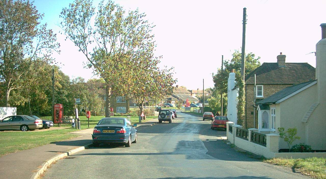
The mid-Kent section westward from Sutton Valence to East Peckham was achieved by catching trains to the village of Headcorn and then a bus to Sutton Valence. The first two thirds of this section feel similar to the section from Pluckley (documented last time), with the path remaining resolutely at the top of the range of hills, with excellent views across the Weald of Kent to the south. Orchards abound and the path passes the gated driveway to Linton Hall. Eventually the route tumbles off of the hills to reach Yalding, a village that used to flood severely on a regular basis. The route then follows a short navigation channel which was built to cut a corner off of the meandering River Medway for commercial vessels.

The hill range takes a while to get back into full flow after the path crosses the Medway Valley, but the next section westward includes the pretty village of Shipbourne (pronounced 'shibbun' and located a few miles north of the town of Tonbridge), with its grassy common land being a prominent feature. The moated manor house at Ightham (pronounced ‘item’) is well worth a short detour. Beyond this, the ridge reasserts itself and one is really quite high up when nearing Knole Park on the edge of Sevenoaks. You may spot a deer here and you will almost certainly pass the odd jogger! The path then falls off of the hills and becomes quite hard to follow, needing to tunnel beneath the A21 to reach the village of Sevenoaks Weald. After a pint of mild and a bag of crisps in the local pub I walked up to the Hildenborough Road and caught as bus to Tonbridge Station.

The next section west from Sevenoaks Weald takes the walker all the way to Surrey, climbing back onto the ridge again to pass the village of Ide Hill, with its conveniently located shop / cafe, and the wooded summit of Toy’s Hill, one of the highest points in Kent. The true highest point is actually Betsom’s Hill on the North Downs above Westerham, which musters over 820 feet in height.

The path then passes Chartwell, which was Winston Churchill’s home for over forty years, chosen by him mainly because the view across the Kentish Weald is so nice. Crockhamhill Common becomes Limpsfield Common as the walker passes into Surrey (it's all just 'woods' to me). Here, there is a marker-stone showing Hamstreet and Haslemere as each being 55 miles away in opposite directions. The walk beyond into Oxted is typically ‘Surrey’ with lots of common land around leafy suburban roads.

Having documented the sections between Oxted and Dorking in my last article, there is just the last 35 miles to report on. I decided to work backwards, catching trains to Haslemere to begin my walk eastwards. Haslemere is a pretty country town, where a plaque commemorates the first police officer in the Surrey Constabulary to die on duty in what is known as the 'Haslemere riot.' Clearly these were different times.

The Greensand Way climbs steeply to the Devil’s Punchbowl at Hindhead, a village that used to endure a near-permanent stream of traffic on the A3. The road tunnels beneath it today and there is not really any evidence that it used to run right through the village, with tasteful landscaping removing all vestiges of this arterial road from London to Portsmouth. After some magnificent northward views the path descends to Thursley village, from where it begins its long bumpy journey eastward to Dorking. The name 'Thursley' is a reference to the Norse god, Thor, and the Devil's Punchbowl was so named because the legend is that Thor and the Devil had a battle here and the punchbowl was created when the dark one scooped out a load of earth from the hills to throw at Thor. A great way to settle a dispute, hey?

I was crestfallen to reach the Dog and Pheasant at Brook to find 'To Let' signs. I had used the pub in 2006 on my initial walk and a beer would have gone down like a snake's foot (as people say down here on Romney Marsh). Instead I continued via Sandhills (the clue is in the name) and Wormley, and I had an evening meal in the Merry Harriers pub in Hambledon. Conversations in 'RP' English reverberated around me as I ate. A few miles beyond, I camped in the Hurtwood. The name has nothing to do with pain, as ‘hurts’ was a local dialect word for bilberries.

The next day was searing hot. Hascombe was quaint with a winding lane, a pond and a pretty church. When I reached the village of Shamley Green, where the ridge has another break to let a river through, I was seriously considering throwing in the towel. However, the next section was mercifully shady as the ridge is heavily wooded here. There are some great viewpoints, and the path descends to pass by the Duke of Edinburgh School and again to pass through the village of Holmbury St Mary. Beyond is Leith Hill, the highest point in Surrey. It is crowned with a tower and seems to be quite a tourist hotspot.

There was just the long slow descent to Dorking to go after this. Time was limited before the train that I needed to catch home, so a ‘meal deal’ in an Esso garage had to make do. There's no point lying - this last section was gruelling in the heat, with no public transport on a bank holiday Monday and no refreshment facilities between Holmbury St Mary and Wotton, by which point I needed to get a spurt on.

All in all, it’s been fascinating to re-walk this long distance path, and I’ve made a few tweaks to my book, ‘Mud, Sweat and Beers’ which documents the route and our continuation westward to the other ‘Ham Street’ in Somerset. It is perhaps inevitable that I will eventually re-walk those paths too. The book can be found on most major digital platforms for those who want to explore more.

The Greensand Way Part I - a Walking Perambulation


‘It was twenty years ago today…’ begin the lyrics of one of the many legendary songs of the Beatles. Twenty years must have seemed a long time to the young Paul McCartney when he wrote these lyrics which opened the 'Sgt. Pepper' album in 1967. After all, in 1947 we were barely over the Second World War and Paul was four or five depending which side of June the 18th we are!

Personally, I think the twenty years since I walked the entire Greensand Way footpath across Kent and Surrey have passed in a flash. The 110-mile trail begins in the village of Hamstreet, about nine miles from the English Channel and ends in the town of Haslemere in a far flung corner of Surrey. For my friend Tom and I, the Greensand Way formed the first half of a challenge to walk to the other 'Ham Street' in Somerset, which I documented in my travel book 'Mud, Sweat and Beers.'

For the 'china anniversary' re-walk I began with the local section, which falls under the borough of Ashford, back in the winter. The very beginning of the path is currently not signed at Hamstreet Crossroads, although I believe there are plans for a local info board to mark the start very soon. The gravel trail up through Hamstreet Woods (one of the UK's oldest national nature reserves) is a gentle and pleasant incline for cyclists, but upon reaching the brow of the hill, it's footpaths all the way to the settlements of Kingsnorth, Chilmington and Great Chart. I was pleased to see that the route of the trail around Chimington hasn’t been severely marred by the recent housing development, retaining a mostly rural feel throughout. Chilmington is essentially becoming a 'new town' bolted onto the southwestern fringe of Ashford. Beyond Great Chart, the route bridges the Ashford to Tonbridge railway line, and I had to abandon my walk due to the path being flooded all the way down to the Great Stour River near Godinton Park. I’ve never been a fan of swimming!

My second recent dabble at the Greensand Way covered the section which runs along the edge of Godinton Park, again not hugely troubled by the suburban developments, before heading west to pass to the south of Hothfield, descending towards the edge of Hothfield Common (a natural peat bog) and then up and over to Little Chart. From here on, I followed the Stour Valley Path to the village of Lenham, where ponds provide the source of one of Kent's longest rivers, which flows via Ashford and Canterbury, out into the English Channel at the little town of Sandwich, which gave its name to, er... sandwiches!

I walked my third section of the Greensand Way backwards (i.e. west to east), catching a bus from the village of Headcorn to pick up the trail at Sutton Valence, heading eastward. This was, and probably still is, my favourite section of the walk. Kent lives up to its epithet of being the ‘Garden of England’ here, with numerous orchards along the route. Whilst the section around Great Chart and Chilmington on my previous amble has the feel of a ridge, this is where the Greensand Hills, which give the path its name, really find their feet. The views southward from the top of the ridge are panoramic, and the path remains fairly high up the slope until dropping off beyond Boughton Malherbe. After Egerton (pictured), the route dips and then climbs again to Pluckley (reputedly England's most haunted village), where the orchards take over again for the descent to Little Chart. After a pint in the Swan’s beer garden, I negotiated a route to Pluckley Station, being somewhat gutted to find that Dering Arms was closed and the next train was in 55 minutes time. Time for some stoicism.

Then on the first May bank holiday, I booked myself a Travelodge in Dorking, with the aim of completing the sections of the Greensand Way west from Reigate to Dorking and east from Reigate to Oxted. Alighting the train at Reigate Station, the town is reached via a foot tunnel, which was the first road tunnel to be built in the UK, opening in 1823. This was constructed for the ease of stagecoaches, travelling from London to Brighton, so-called because these long journeys were completed in stages, with a change of horses being needed at regular intervals. The route of the Greensand Way to Dorking was far more scenic than I remembered it from 2006. The path drops dramatically into the valley of the River Mole, which runs from Gatwick to the Thames. The Greensand Ridge doesn’t reassert itself until Dorking area, leaving the North Downs on the right hand side to dominate the skyline. I passed through the pretty villages of Betchworth and Brockham and passed a small woodland that I camped in during that original thirteen-day hike. I described this as ‘cake shaped’ in my book and I can confirm that it still gives that impression! The 'cherry on top' was passing a blue plaque in Dorking marking Strawberry Studios where 10cc, Paul McCartney, Steveie Wonder and others had all recorded music.

On the following day I would catch the train to Reigate and walk the ‘GW’ eastward. It was nice to walk a section of the trail that my friend Tom and I had completely missed twenty years ago, having made a hash of the map-reading, ending up in Redhill town centre. Thankfully, modern smartphone apps make following a trail of this kind much easier today. However, signage for the trail was still non-existent on the lanes to the west of South Nutfield so I reported this to Surrey County Council. Modern smartphones make this easier too!

My lunchtime refreshment break was at a pub in Bletchingley, a village straddling the A25 at the top of the ridge. It was doing brisk business and the barmaid was clearly feeling the pressure. The next section feels similar to the Pilgrims’ Way, a more famous trail which runs along the (also more famous) North Downs. Here, the 'GW' runs along the lower part of the ridge’s scarp slope in an easy-to-follow straight line. Crossing the busy A22 near Godstone was more of a challenge, but the section via Tandridge to Oxted passed very quickly. Oxted is perhaps most famous for the being the childhood home of a certain Keir Starmer. Not far from here is the furthest known mention of Hamstreet, where the ‘GW’ crosses the Kent border, with the village signed as being 55 miles away but we'll be visiting that in 'Part II' of this report. For now, we'll trundle down to Hurst Green Station and catch the first of four trains home.


Thursday, 26 June 2025

Hamstreet, Kent - Concise Information for Visitors


Location: 6 miles south of Ashford, Kent

Population: 1988 (2021 census)

Parishes: Orlestone and Warehorne 

New Book on Hamstreet OUT NOW


Introduction to Hamstreet

The village of Hamstreet used to be a mere hamlet known as ‘Ham’ with most of the population living at Orlestone, a small settlement based around the pretty parish church of St Mary one mile north of the village.

When the Romney Marshes were properly drained, Hamstreet became more desirable, being strategically located at the cross of the Ashford to New Romney road and the current Tenterden to Hythe road. The coming of the railway in 1851 boosted the village’s growth, which has continued steadily throughout the last hundred years. The Ashford to Hastings line is now one of only two diesel lines in the provincial Southeast.

Today, the village encompasses Orlestone parish and part of Warehorne parish. The village is twinned with Therouanne in France.


Countryside

The area around Hamstreet is relatively unspoiled, in spite of the busy bypass (built in 1994) and the southward growth of Ashford. There are many traditional Kentish weatherboard buildings at the village centre. The flat nature of the marsh means that the quiet winding lanes are very popular with cyclists. There are also three long-distance footpaths here: the Greensand Way, the Saxon Shore Way and the Royal Military Canal Path

The first two paths pass through Hamstreet Woods (SSSI), which is a large protected reserve of deciduous woodland where you will find many trails and may even hear a nightingale. A second area of public woodland can be found a mile north of Hamstreet at Faggs Wood / Orlestone Forest.

Link to walking guide here:

Link to cycling guide here:


Fame

Hamstreet had its moment of fame in 1991, appearing in map form on every postage stamp in the UK. This was to commemorate 200 years of the Ordnance Survey, because the Hamstreet area was the first to be mapped as part of a nationwide survey. The set of four stamps effectively illustrated the changes to the village over time.

Hamstreet was also featured in BBC TV's ‘Blue Peter’ as the 'base camp' for a humorous charity exercise involving climbing the 'Marsh Mountain.'

The writer, Joseph Conrad once lived near Hamstreet, and Noel Coward owned a residence at nearby Aldington, where several TV personalities have also lived. H E Bates would have been familiar with the village, and the wider area of Romney Marsh has many literary connections, including the Dr Syn books and the Ingoldsby Legends.

There is also a memorial at Johnson’s Corner (the southern bypass exit for the village). This marks where a heroic American pilot crash-landed in the Second World War after allowing his crew to parachute to safety.


Leisure

Hamstreet is a popular base for ramblers due to its variety of shops, station, Old Schoolhouse Indian restaurant, chip shop, Cosy Kettle cafe and pub.

The Duke’s Head was originally located on the High Street itself, but was rebuilt in the 1930s back from the road to accommodate coaches. The Pavilion (Pound Leas) is another popular venue.

An ale trail can be enjoyed by heading along Warehorne Road and onto the Saxon Shore Way across the fields, to the 16th century Woolpack Inn, which is linked to the church of St Matthew by an underground smugglers' tunnel. Although small, Warehorne used to have a second pub – the World's Wonder, one of five in Kent built to the same design.

Alternatively one can follow the canal path east from the garden centre (half a mile south of Hamstreet village centre) for 2½ miles and wander uphill along the lane at the second bridge to the White Horse, Bilsington. You will notice a monument dedicated to a local landowner, Sir Richard Cosway. Sadly Ruckinge (passed en route) surrendered its Blue Anchor pub to history in 2015.

Full village blog page here:


Saturday, 7 January 2023

How Big Is Ashford? / One Goes Mad In Dorset

I may be in a minority but every ten years I find it interesting to pore over the population figures when the census results are released.

It's particularly interesting down here in Kent, as my hometown of Ashford is often said to be of the fastest growing in the country, spreading rapidly across the farmland to the south of the town. I heard that a local songwriter once wrote a ditty along the lines of 'Come to Ashford before Ashford comes to you (credit is available if the composer comes forward!).

Well, the official figure shows an increase from 67,000 people to 76,000. However, I would argue that the boundary of what is regarded as Ashford should include modern developments like Park Farm, Finberry and Chilmington in their entirety. This 'urban area' figure gives a population of 84,000 (up from 74,000), which seems more representative. I imagine that service providers and businesses look at population figures when deciding whether or not to locate in a town, so it makes sense to me for the powers that be to revise the boundaries of what is regarded as 'Ashford' to include all the suburbs as it grows. I did suggest this (along with other tips for improvement) to our local MP as well as Ashford Borough Council when I was bored during the lockdown. I guess they must be working on it!

It has often been rumoured that Ashford will end up being the largest town in Kent, so you may be surprised to learn that Maidstone now has 121,000 inhabitants and is actually growing at a faster rate. In provincial Kent, Ashford is second in size after the county town, but if you include Dartford and Medway, which the 'City Population' website doesn't include in the Kent list, you will find that Dartford, Gillingham and Chatham are all still larger than Ashford.

Apologies to my non-local readers that the first half of this post is very much a local post for local people, but I then extended my number-crunching to the borough's villages.

The built-up area population is the best available gauge of village-size, and if you disqualify villages that have part of Ashford in their designated built-up area, the top ten largest are Charing, Wye, Hamstreet, Brabourne Lees, Shadoxhurst, High Halden, Biddenden, Woodchurch, Bethersden and Challock. One is tempted to record an audio clip reciting the list over the 'Pick of the Pops' music in the style of Alan Freeman!

If you look at parish populations the list is different as parishes vary wildly in size and some villages (like Hamstreet and Brabourne Lees) run across two parishes. I guess all this reminds us to be very careful when presented with statistics, as strategic use of figures can be summoned to bolster any point of view. If you want to say 'enough development' or 'bring it on,' you just choose the set of figures that best suits your point!

I recently took a trip to Bournemouth to try to break up the 'winterregnum' between Christmas and New Year (when the weather outside is frightful). With roughly 80,000 more people than Maidstone, certain parts of Bournemouth have a 'city' feel, but there are some delightful walks through the green arteries that follow various streams (or bournes) down to the sea. I found myself watching the kite-surfers in Poole Harbour one day and walking to Christchurch another day to admire the abbey. The name for this particular settlement comes from the abbey itself, which was so-named because during construction a large beam seemed to mystically appear roughly when an unknown carpenter vanished. I'm sure you can guess who locals thought this carpenter may have been, and the name just stuck.

Another interesting spot was in Bournemouth itself, this being the grave of Mary Shelley, the author of 'Frankenstein,' which is arguably the world's first science fiction book. I guess you could say that it is this author's idea of finding inspiration. Check out Digital Psychosis for the latest offering which I like to think was momentarily the world's newest science fiction book when released. Forget Prince Harry 'going spare' - you'll hear all about it on the news anyway - this is the 'must have' book for 2023 (even if I say so myself!).


Saturday, 12 December 2020

Ashford, Kent - Portrait of a Town

[NEW LAYOUT WITH CLEARER SUGGESTIONS FOR THE TOWN. Last updated April 2026]


New book on Hamstreet includes an expanded chapter based on this web page - OUT NOW


Introduction to the Town


The town of Ashford is centrally located in Kent and twinned with Hopewell in the USA, Fougères in France and Bad Münstereifel in Germany. The latter two have link roads to motorway junctions named after them. Historically Ashford was in the Hundred of Chart & Longbridge, within the Lathe of Scray, which ran across central Kent from the Swale to the Weald.

In 2005 the town was voted the fourth best place to live in the UK. The cathedral-like parish church of St Mary the Virgin, and indeed the town centre around it, occupies a higher area of land to the west of the River Stour, overlooking the flatter ground which surrounds the town. Ashford is sandwiched between the North Downs, England's second longest hill range, and the Greensand Ridge which is more visible west of Pluckley and east of Aldington.

The church's tower shares the skyline with the Panorama (formerly Charter House), currently Ashford's tallest building, as well as International House, another imposing block located near the railway station. A new block dubbed 'The Ashford Shard' has been granted planning permission. The Great Stour, East Stour and South Stour rivers all join in Ashford to flow through the North Downs to Canterbury and Sandwich. The former H.S. Pledge & Sons mill is Ashford's main river feature. It was later used for the nightclubs Dusty's, Cales & Flatfoot Sam's and finally Liquid & Envy.

The town was originally known as Essetesford and is recorded in the Domesday Book of 1086.  A residential road in South Ashford uses a variation of this name. The town's cattle market was moved to an out-of-town site in the 1990s and Ashford has many modern buildings, such as the college and the new office block in Station Road. However, a haven of tranquillity can be found around the churchyard where you will also find Ashford Museum. The Gateway Centre which houses the tourist information centre and the library is nearby.

The town's high street is completely pedestrianised, having once been the main A20 road 
from London to the Channel ports of Folkestone and DoverWorth visiting are the windmill in a quaint corner of Willesborough, the ornamental fountain in Victoria Park and the World War I tank in St George's Square which had its mechanics removed and replaced with an electricity sub-station in 1929, ensuring its survival as a feature. Sadly the borough council are currently considering removing this remaining piece of Ashford history to a museum in Dorset.

Ashford was bypassed in the late 1950s and this was upgraded to motorway in the early 1980s. A ringway was constructed around the town centre in the early 1970s. This gained a reputation as a racetrack (see the video on YouTube) and has since been broken up into a main thoroughfare for the A292 on the north of the town centre and a series of 'shared space' streets to the south. This was the first scheme of its kind in England, prompting a humorous comment from TV's Jeremy Clarkson.

And while we are on the subject of roads, in 1914 the London to Folkestone road in Ashford was the first road in Britain (and arguably the world) to be adorned with central white lines. This was possibly in the vicinity of Maidstone Road but this needs verifying. 


Claims to Fame


It has often been rumoured that 'Bond' star Roger Moore once lived in the town. Disappointingly online research reveals that his parents once considered buying a property at the junction of Canterbury Road and Faversham Road but didn't follow through. However, one famous name who did play James Bond in a radio adaptation of 'Moonraker' is Bob Holness who grew up in the town and attended the grammar school. Bob Holness was perhaps most famous in the 1980s as the presenter of the TV quiz, 'Blockbusters.' Ashford itself was the setting for the ITV drama series 'Stolen' in the early 1990s.

The Tour de France passed through Ashford during its British leg in 1994 and again in 2007. Famed author Frederick Forsyth was born in the town, as was Sir John Furley, founder of St John Ambulance. Philosopher, Simone Weil, who lived in Ashford, and conductor, Malcolm Sargent, who was born in the town, both have roads named after them. The mathematician John Wallis, who tutored Isaac Newton and has been credited with inventing the infinity symbol, was born in Ashford and has a former pub and a school in the town named after him. Former England football manager, Roy Hodgson, once played for Ashford Town FC.

The town's William Harvey Hospital, named after the physician from Folkestone who discovered the circulation of the blood, is well located near the motorway to provide an A&E service, especially with the rapid expansion of the town to the south into the neighbouring Weald of Kent parliamentary ward. The 2021 census gave an urban population of 83,000. Development seems to be spreading ever further out to the south and whilst actual flood plain land should clearly not be built upon, this lop-sided approach to growth seems very peculiar. 

The annual Create music festival in Victoria Park attracts big names, with the Lightning Seeds headlining in 2019. There is also a regular music festival in North Park (near the Stour Centre).

SUGGESTION: A 'wall of fame' or 'walk of fame' in the town centre with Hollywood-style stars celebrating famous residents like Bob Holness, Frederick Forsyth, Sir John Furley, John Wallis and Simone Weil, as well as the connection with Roy Hodgson. Perhaps the empty space in the high street where the entrance to Park Mall used to be would be a perfect location for this, along with the placing of a plaque of some kind in the town to commemorate the first British road with white lines.

SUGGESTION: Ensuring that new southern estates which fall in the Weald of Kent parliamentary ward are still viewed as part of Ashford and that their populations are incorporated into the official population of Ashford (important for businesses and services considering Ashford as a location).

Trains & Planes


Ashford International is a railway station located between London and the Channel crossings of Dover and Eurotunnel. The station has the largest number of platforms in Kent (six), with a domestic entrance to the north and an international entrance to the south, with lines diverging to the following destinations clockwise: 

NE) Canterbury, Ramsgate and Margate. 
E) Folkestone, Dover, Deal and Sandwich. 
SE) Eurostar services to Paris or Brussels via Lille (currently suspended)
S) Rye, Hastings and Eastbourne.
W) Tonbridge, Sevenoaks and London Charing Cross. 
NW) Maidstone and London Victoria. 
NNW) High Speed services to Ebbsfleet, Stratford and London St Pancras.

The villages of Wye, Chilham, Hamstreet and Charing (all within the borough) have reasonably central stations too. Appledore and Pluckley also have stations which are some distance from the villages.
Remarkably a rail halt to serve Park Farm and the estates to the south of the town which has been proposed since the 1990s still hasn't got off the drawing board.

London-Ashford Airport is located at Lydd. A former airport at Lympne was known as Ashford Airport prior to this.

No Direction Home?


The town is well served by main roads, but how far would you have to travel in each direction before there are no signs back? The answer is 'not as far as twenty years ago.' For example, the town no longer appears on the route confirmation sign when joining the M20 east of Swanley, or on any signs in Tunbridge Wells, New Romney or Hythe. This seems peculiar when the town is expanding so rapidly. My own 'Ashford and Shepway Roads Database' blog details many routes around the wider area for those interested in local journeys. The following suggestions could all improve the profile of Kent's second largest town (excluding Medway).

SUGGESTION: National Highways could include Ashford on the route confirmation signs on the A20 leaving Dover (20 miles) and near West Hougham (17 miles), and on the M20 near Swanley (37 miles). Also the town should be signed on the A259 south of Brenzett as it is the first primary destination reached via the trunk route which meets the M20 at junction 10A.

SUGGESTION: KCC's highways department could reintroduce Ashford on signage at the A21/A262 junction near Lamberhurst or sign an alternative route to the town avoiding Goudhurst (e.g. 'For Ashford use A228 and M20'), as well as at the A28/A268 junction north of Newenden.

SUGGESTION: East Sussex County Council could sign 'Ashford (A28)' from Bexhill on the A2690 as this is essentially an extension of the A28 route. This might also be beneficial to reducing traffic along Hastings seafront.

SUGGESTION: Placing of a 'Welcome to Ashford' sign on the A2070 in the vicinity of Park Farm. New 'Rotary Club' entry signs have been placed on other main roads into the town which is a great improvement, although the signs could be moved out to incorporate estates like Chilmington, Singleton, Park Farm and Finberry into the town.

On Your Bike

 
For cyclists, Route 18 heads southwest to Tenterden and Tunbridge Wells via Shadoxhurst, and in the opposite direction it runs northeast to Canterbury via Wye and Chartham. Meanwhile Route 17 heads northwest towards Maidstone and the Medway towns via Charing and uses the Pilgrims Way, an ancient trackway which runs along the bottom of the North Downs. There is also a local route numbered 11 to Lydd via the villages of Appledore and Woodchurch.

There are two lakes in the town. Singleton Lake can be found along Route 18 towards Tenterden, and the larger Conningbrook Lake can be found off of Route 18 towards Canterbury.

SUGGESTION: Encouraging non-vehicular movement between disparate areas of the town by blue-signing or green-tarmaccing a route linking the designer outlet, the railway station (via the subway), the town centre (via Station Road or East Hill) and Eureka Park (via St Teresa's Close, Quantock Drive and the Eureka Bridge to halve the length of the current signed route). A board at each area listing stores and outlets at all the areas along the route would encourage cohesion between these areas and improve perceptions of the town as a whole.

SUGGESTION: Blue-sign radial routes to the town from villages currently not connected to the cycle network, perhaps with input from Sustrans.

1) To Hamstreet via the cycleway from the designer outlet / Asda to Park Farm, the path to Church Hill, Bond Lane, Ashford Road, Bromley Green Road, Poundhurst Road and the surfaced bridleway through Hamstreet Woods. Full details in ‘Leisure route to Ashford’ here.
2) To Brabourne Lees via Willesborough, over the A2070 bridge to Sevington Church, Kingsford Street to Mersham, then Bower Road and The Ridgeway to Brabourne Lees.
3) To Headcorn from Route 18 at Singleton, under the A28 subway to Great Chart and along lanes to Daniel's Water, Bethersden (via path from Kiln Lane), Smarden and Headcorn.

Pub Crawl?


If you've ever wondered how many establishments you'd need to visit to say you had been to every pub in Ashford the general answer would be 'Not as many as a few years ago.' Whilst this is sadly true, let's see how many we can tally up. I've included traditional venues that now include restaurants and hotel facilities as long as they remain venues where customers can merely go for a drink:

Town Centre (11): The County Hotel (Wetherspoons), the Glass House, Valerie's Wine Bar, the George, the Old Golden Magpie (Ashford Music Shop site), Durbar (formerly the Auction House), Jay’s Soul Food (formerly the New Prince of Wales), Players (formerly the Phoenix), the Swan, the Taproom and the Coachworks.

Willesborough axis (7): The New Fox (formerly the Windmill), the Alfred Arms, the Albion, the William Harvey, the Blacksmith's Arms, Hooden Smokehouse, the French Connection.

Kennington axis (8): The Conningbrook, Stubbs, the Old Mill (formerly the Golden Ball), the Rose, the Pheasant, the Bybrook Tavern (at Holiday Inn), Bybrook Barn (Harvester), the Hare and Hounds.

South Ashford axis (6): the New Chimneys, Singleton Barn, the Fish Inn (formerly the Crusader), the Beaver Inn, the Locomotive and the Riverside.

If we include the contiguous settlements of Kingsnorth and Great Chart and broaden the definition of 'pub / bar' a bit, the tally can be cranked up to 38, with the Queen's Head, the Swan & Dog, Cameo nightclub, the Ashford Club, Frankie & Benny's and Curious Brewery.

Currently closed are the John Wallis (the boarded up former Man of Kent), the Star, and Cappadocia (formerly Platform Five).

Dining, Shopping & Entertainment


As far as dining goes there are many quality restaurants in the town centre including Beunos Aries Nights (Argentinian), Aspendos (Turkish), Jay's Soul Food (Caribbean) and Amici (Italian). There are numerous Indian, Chinese and Nepalese restaurants in the town centre, as well as Kokoro and Pizza Express, which also has an outlet at the designer outlet, a twenty-minute stroll away. Other 'outlet outlets' include Wagamama, Five Guys and YO! Sushi. A twenty-minute walk in the opposite direction via Quantock Estate and the Eureka bridge will bring you to Eureka Park (this 'quickest walking route' should surely be signed?). Here you'll find restaurants including Nando's, Frankie & Benny's and Beefeater.

Perhaps the crux of why Ashford is sometimes incorrectly perceived as somewhat lacking is that its restaurants and big stores are dissipated all over the urban area, leaving the town centre increasingly facing an uphill battle, while pedestrians struggle to reach the outlying attractions which have clearly been designed around the car. At present visitors to the town probably assume that Ashford simply doesn’t have big names like Argos. Nando’s, Wagamama and M&S. Ashford's former John Lewis store has reopened as The Range.

The designer outlet attracts shoppers from all over the Southeast and is the largest tented structure in Europe, even eclipsing the O2 arena (formerly the Millennium Dome). Meanwhile the town centre has the County Square shopping centre. In spite of vociferous public protest, Park Mall shopping centre is currently being demolished to make way for a car park and (probably much much later) a residential development. A popular sports bar (Matches) has been bought out by the borough council to make way for a second bowling alley among other leisure uses.

For entertainment the town has two cinemas. The larger of these is at Eureka Park and the newer cinema is in Elwick Place. Ashford also has a modern ten-pin bowling alley, the Stour Centre for sports and swimming, the Julie Rose Stadium and 'Revelation at St Mary's' which stages music concerts and performances at the parish church, with some big names such as Fairport Convention and Creedence Clearwater Revival having performed there. Whilst this is a great innovation, residents have routinely expressed a wish for an actual theatre in the town which seems to be an unacknowledged anomaly when Ashford is larger in population than Folkestone, Canterbury and Margate, all of which are well-served theatrically.

Conclusion


This is not one of the routine 'Ashford bashing' blogs that make local headlines from time to time, but one written by a lifelong resident of the borough who would like to see the town flourish, preferring the slightly tongue in cheek nickname of 'Ash Vegas' to the ubiquitous (and dated) 'Trashford,' which was actually originally used in a headline concerning littering.

With the borough council insistent that demolishing Park Mall shopping centre was for the best and now considering removing the tank - one of Ashford’s few unique features, the town centre is in even greater need of a draw than ever. This could be the long-awaited railway museum or a theatre. Either way, this could be the final opportunity for the borough council to prove itself to an increasingly sceptical public who have heard so many empty promises, the most recent being shelved plans for a Netflix studio. 

There are obvious eyesores that detract from the town centre, such as the seemingly forever-in-limbo New Rents hotel project, the area around and including the Man of Kent pub, and the flour mill (formerly a nightclub). Acting on some of the suggestions in this blog post would at least be a step in a more positive direction for the town but is anybody listening…?

Credits


This page has been put together by Adam Colton, a local author of UK travel and psychological fiction. Please visit the author page on the Amazon website, Smashwords, iBooks, etc. for details of available books. Adam is also one half of the musical duo Adam Colton & Teresa Colton. Check out their songs on YouTube, Spotify, iTunes and other music sites.

This page may omit other aspects of the town which might deserve attention. I am happy to correct any errors and will consider any glaring omissions. For all else, you can always produce your own blog!

School report for Ashford: has potential; just needs more focus.

There is sister-page on this blog about the nearby village of Hamstreet here.

Hamstreet, Kent - Portrait of a Village

[Transcript of original web page. Last updated Apr 2026]


LATEST NEWS: 

New Book on Hamstreet OUT NOW
New beauty outlet
Existing beauty outlet moves to new site
Village currently has two vacant shop units
Online parish magazine free to view

Introduction to the Village


"Hamstreet is 'interesting' and retains the characteristics of a traditional and proud working village, something that is increasingly rare," - Kent Life Magazine.

This Kentish village is affectionately known as the 'Gateway to the Marsh’, being located six miles south of Ashford where the ridge of clay hills meets the flat expanses of Romney Marsh, an area once awash with smuggling. The village was bypassed in 1994, but remains an important junction and is twinned with the little town of Therouanne in France. Therouanne was once a city with a cathedral which was sacked by the troops of Henry V. The stone cannonball near the flagpole in Hamstreet was a gift from the mayor of the twin town, presented with the words 'You can have your cannonball back!' More local history can be perused on the Forge Gardens noticeboard and at the station.

Traditional weather-board buildings and a generally unspoilt appearance make the place well worth a detour from the beaten track. Three long distance footpaths pass through the village; the Royal Military Canal Path follows the peaceful banks of a 28-mile waterway - the UK's third longest defensive structure, and the Saxon Shore Way and Greensand Way pass through the expansive deciduous woodland of Hamstreet Woods (comprising Bourne Wood, Carters Wood and Barrow Wood). In fact, the Greensand Way begins its 110-mile course to Haslemere at the village crossroads. A walk incorporating both the canal and Hamstreet Woods was featured in the 'Top 50 best summer walks in Britain' in the Independent newspaper. A second area of public woodland is located northwest of the village at Orlestone Forest.

To get a reasonably accurate population for the village as a socio-economic entity, add together the populations of Orlestone and Warehorne, for the boundary runs through Hamstreet itself. This amounts to 1,988 people (2021 census). Orlestone is the original location of the village - now just a hamlet, a mile to the north, centred around the parish church of St Mary, which was built in the late 12th or early 13th century. The Church of the Good Shepherd is a more modern place of worship in the village's High Street and the ancient church of St Augustine's in Snave also comes under Hamstreet and holds one service annually at harvest festival. The church in Warehorne is dedicated to St Matthew. The area is great to explore on foot or by bike.

Hamstreet's Claims to Fame


H E Bates who wrote 'The Darling Buds of May' would have known the village well, and the writer Joseph Conrad resided at Capel House (one mile north of the village) from June 1910 to March 1919. The modern generation will perhaps be most familiar with the film 'Apocalypse Now' which was heavily influenced by his book 'Heart of Darkness.' In the late 1990s, the village pub was briefly managed by Patrick Murray who played Mickey Pearce in TV's 'Only Fools and Horses.' Many celebrities have lived within the wider local area including Vic Reeves, Bob Mortimer, Paul O'Grady, Noel Coward, Julian Clary, Alan Carr, the actress Jan Francis and international golfer, Peter Mitchell. An online photo also shows 1960s pop star, Billy Fury, at his rural retreat at Poundhurst Farm in nearby Ruckinge. Hamstreet has also been featured in futuristic writings by Sir Peter Hall and David Boyle. But what of the village itself?

Mountain Farm in Hamstreet once featured in BBC TV's 'Blue Peter' as a base camp for an expedition up the 'Marsh Mountain’. Romney Marsh is of course completely flat, so this humorous concept involved presenters turning a map of the area upside down and crawling along the road!

Hamstreet had its real moment of fame in the early 1990's, with maps of the village appearing on postage stamps all over the UK. John Craven even did a 'Countryfile' special on the village. This was to mark 200 years of the Ordnance Survey. Hamstreet was chosen because the area was the first to be mapped as part of a nationwide survey and the changes to the village over the years showed up very well on a series of stamps.

The village was featured on BBC South East Today's 'On The Map' feature in May 2021. Hamstreet was also on the route of the Tour of Britain cycle race which passed through in September 2006, and the Olympic Torch relay passed through the village en route to London for the 2012 Olympic Games. Search for 'Olympic Torch Hamstreet' on YouTube to view the relay and watch TV clips of the village here.

Business


Until 2013 there were five pubs within three miles of the village cross. At present there are three - the Duke's Head in Hamstreet itself, the Woolpack Inn in Warehorne and the White Horse in Bilsington. The Blue Anchor (Ruckinge) and World's Wonder (Warehorne) have sadly been allowed to disappear.

In the High Street there is a post office / general store, fish and chip shop, the Old Schoolhouse Indian restaurant, a curtain / blind shop, the 'Saw Joinery' DIY/joinery centre, Lilly's Ink tattoo studio, the Cosy Kettle cafe, Early Birds renovations and Smart Dogs grooming centre. The Woodville unit is currently vacant. 

Marsh Road has Annings Motors garage and Hamstreet Garden Centre which also has a cafe. There is currently an empty shop unit at the garage. Hamstreet Primary Academy (the school) is located in Ashford Road. Joanne Fuller Beauty is located in new premises at the top of the hill near Orlestone.

In Warehorne Road there is a dental clinic, L&K hair design and Angela Hirst estate agency. Travel just out of the village and you'll find a vineyard, the mild climate of this part of Kent being particularly good for wine production.

Meanwhile, Ruckinge Road is the location of Hamstreet Surgery, as well as the Nexus Programme office. The unit next to this office is now the Beyond Beauty studio. A little further out of the village on Ruckinge Road is Meadow View Industrial Estate which contains several businesses.

Fun and Festivals


The village has a games area/tennis courts and a bowling green, as well as many clubs and associations too numerous to list. These include the Ruckinge and Hamstreet Scouts and Guides (HQ in Ruckinge), the Royal British Legion and the football club. Many activities and clubs take place around the village at locations such as Victory Hall, Cosy Kettle cafe, primary school and Church of the Good Shepherd (which has its own hall attached). 

The Pound Leas pavilion has its own bar area, augmenting the flood-lit 'multi-use games area' and football field, all of which are the result of many years of fundraising. The parish council has purchased the adjacent field to expand facilities further. The Festival of Transport which used to take place every June was featured in a Live TV (satellite) documentary programme in 2009. Sadly this event folded in 2016 but the village does have a community music day each summer in its place. There are also regular 'bike jumble' events on the fair field for petrol heads. 

Also look out for posters for Hamstreet bonfire and fireworks on Pound Leas each November (although this didn't take place in 2024). Warefest, an annual music festival in Warehorne sadly folded in 2024. For those wishing to stay locally, accommodation is available at the Woolpack Inn, a pleasant stroll across fields on the Saxon Shore Way.

Transport facts


As well as daytime bus services to Ashford, New Romney and Lydd (Mon to Sat), Hamstreet has a railway station on the Ashford to Hastings line - one of only two remaining diesel lines in the provincial Southeast. Trains run direct to Rye, Hastings and Eastbourne as well as to Ashford for connections to London.

The village is well signed on the A2070 trunk road between Ashford's Southern Orbital Road and Brenzett, and between Aldington and Woodchurch on the B2067. The village used to be signed comprehensively in Tenterden and also from New Romney, Lympne and Appledore Heath. In spite of past campaigns for a return to better signage on grounds of being a junction point on a trunk road and a hub for local services, the village remains signed at the most basic level. Interestingly, there is a memorial at the southern exit for Hamstreet on the A2070 in honour of Liuetenant Johnson, a USA pilot who lost his life here during World War II after allowing his crew to parachute to safety. 

Details of useful cycle routes can be found in the 'Royal Military Canal and Associated Routes' blog, and circular walking routes can be found in the 'Smugglers and Saxon Shore Walks' blog. The A2070 and B2067 also have narrative blogs on this site detailing features along these routes, and the 'Ashford and Shepway Roads Database' blog details routes around the wider area.

Nostalgia 


The house on the corner of Ashford Road and Warehorne Road is believed to be the oldest in the village. It was a bakery until the 1980s, and a post office too until 1970, when a new post office was built at Bridgewell (now a private house in the one-way street). In the 80s the post office moved to the Mace store (now an office), finally settling at its current location in the Morrisons store, which itself was previously an independent store, then VG, Costcutter and McColl's. Hamstreet was briefly graced with a baker's shop again when the Chocolate Box newsagency closed in 2012. There was a second newsagency (Harden's) located at Old Stores House in The Street until the 1990s.

Prior to use for beauty purposes, the shop at Woodville was an antiques shop, and before this a butcher's store. When the butchery closed in the 1980s, a butcher's counter was positioned at the rear of the VG store (now Morrisons) for a number of years. Villagers had a choice of garages, both with filling stations, at the time too. The second of these, Tippen's, was located where the small housing development between the former Chocolate Box and the church now stands.

Until the 1990s Hamstreet had a police house in Warehorne Road. The Indian restaurant was the original site of Hamstreet School until the current school was built in 1882. Prior to its current use the Old Schoolhouse was an antique shop, a photocopier centre, a tea room and the Masters restaurant.

The shopping area in Warehorne Road housed a greengrocer and a wool shop in the 1980s. It is also believed that when Viaduct Terrace was constructed in the 19th century, there were plans for the southernmost end of the terrace to be a pub. The Duke's Head is in fact a 1930s rebuild; the original pub opened its front door directly onto The Street and was originally named 'The George', 'The Three Mariners' and then 'The Duke of Cumberland'. The twin pub of the current Duke's Head was the former Stonebridge Inn at Woodchurch. Hamstreet also had a twin station building, at Winchelsea in East Sussex. The station, opened in 1851, was called Ham Street & Orlestone from 1897-1976 and had a foot crossing until 2014.

Meanwhile, the former World's Wonder in Warehorne was one of five Kentish pubs which were built to the same design. The others were the now-bulldozed Ship at Lade (Romney Marsh), the former Bell Inn at Coxheath, The Redstart Inn at Barming and The Papermaker's Arms at Hawley (Dartford).

Hamstreet exchange phone numbers consisted of four figures prior to standardisation of the 01233 Ashford area code. The telephone exchange is still located next to the railway station. The old exchange is located at the top of a flight of steps to the south of the railway bridge in Ashford Road.

Development names for recent estates were Orchard View (Bankside), Saxon Woods (Lancaster Close), Brook Gate (Orlestone View), The Pippins (Ingoldsby Lane, etc.) and Nightingale View (Brimstone Road, etc.).

Campaigning


There are two vacant shop units in the village centre which the creator of this blog hopes will be filled to keep the village centre buoyant.

Two large new housing developments are being completed. The focus on expensive four and five-bedroom houses within new developments has been an issue, while the further fragmenting of the village across two parishes means a lot of the extra council tax going to neighbouring villages rather than Hamstreet. It would make sense for any new developments to be entirely within the parish of Orlestone to create cohesion.

In 2008 Pumpkin TV produced a DVD for geography students which used Hamstreet as a case study for challenges that affect many English villages. It has sometimes been very frustrating to see a minority fighting plans for new business when so many outlets have been lost over the years. Beginning in the late 1990s the author of this site has attempted to challenge the status quo. 

This began by escalating complaints when the village's railway station ticket office was closed for a period of over six months in the late 1990s, and continued with expressing support for the Indian restaurant to be allowed to provide a takeaway service, for the doctor's surgery to expand, for a fish and chip shop to be allowed, for a new cafe to be allowed and for changes to the Woolpack Inn which ultimately enabled this popular pub to reopen in 2015. Most recently pressure was put on developers to replace a village nameplate which had been missing for seventeen months. A plan to upgrade the canal towpath as a proposed cycle link between Hamstreet and Appledore has sadly still not materialised.

The truth is that one person cannot change a village, and I would personally encourage villagers to use the 'search' and 'comment' facility on Ashford Borough Council's planning website to support new amenities and object to further losses of business space whenever such proposals arise. I hope that the quote from 'Kent Life' magazine which began this post will be as true in years to come as it is at the time of writing.

Credits and links


This page has been put together by Adam Colton, a local author of UK travel, music reviews and psychological fiction. Please visit the author page on the Amazon website, Smashwords, iBooks, etc. for details of available books. Adam is also one half of the musical duo Adam Colton & Teresa Colton. Check out their songs on YouTube, Spotify, iTunes and other music sites. Also, please search for the names of any of the businesses, clubs, amenities or venues mentioned on this page that aren't listed below.

The twin village of Therouanne (link here) in France

Hamstreet & District Sports and Leisure Association

Hamstreet Woods national nature reserve

BBC news report on the 2012 Olympic Torch relay here


Morrisons Store (The Street)

Dog grooming centre (The Street)


Joanne Fuller Beauty  (Ashford Road)

Nexus Programme Office (Ruckinge Road)

Doctor’s surgery (Ruckinge Road) 

Beyond Beauty Studio (Ruckinge Road)

Dental Clinic (Warehorne Road)

Angela Hirst Estate Agency (Warehorne Road)

Hamstreet Wines (Warehorne Road)

Warehorne Vineyard (Warehorne Road)

School (Ashford Road)

Dukes Head (The Street)

White Horse (Bilsington)

Woolpack Inn 
(Warehorne)

Scout and Guide Associations (shared with Ruckinge)

The Victory Hall committee

Link to 'bikejumble' events 


The parish council's site is here


There is now a sister-page on this blog about the nearest town of Ashford